
Sunday 10th September, 2023
Day 9
Dow Bank to Coniston Sports & Social Centre – 10.5 miles
06:40
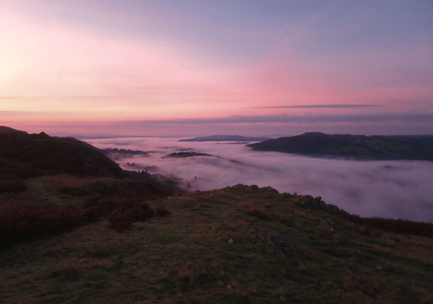
Morning, and look how wonderful this is! I woke at 6am and peeked out of the tent to witness a fantastic inversion in the valley below. It is now sunrise, and there’s a wonderful red glow on the horizon, with stillness in the air.
I had a wonderful sleep last night — the best so far — and I feel totally refreshed for the day ahead. My feet are feeling much better now too, so I’m confident they will get me over the finishing line in four days’ time.
07:20
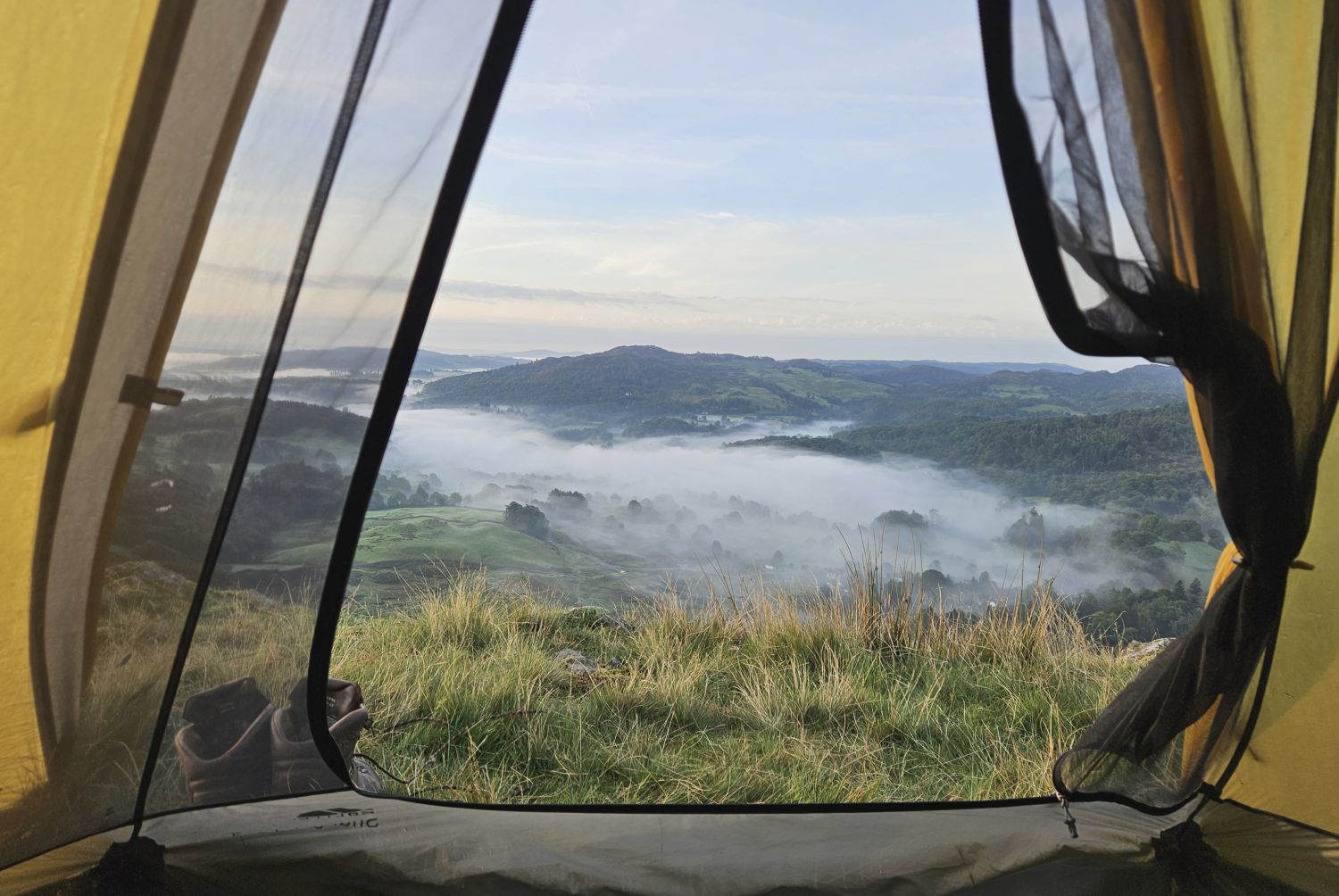
I had a good wander around to take some photos and I’m now having my morning coffee. I’ve no rush at the moment, so I can let the tent dry out a little. Sitting here sipping coffee and looking at the view through my tent is sheer bliss. It’s nice to watch the inversion retreat as the early rising sun warms the valley below. I don’t want to leave, but I have a full English breakfast waiting for me in the village a short distance away. There’s no better incentive than that!
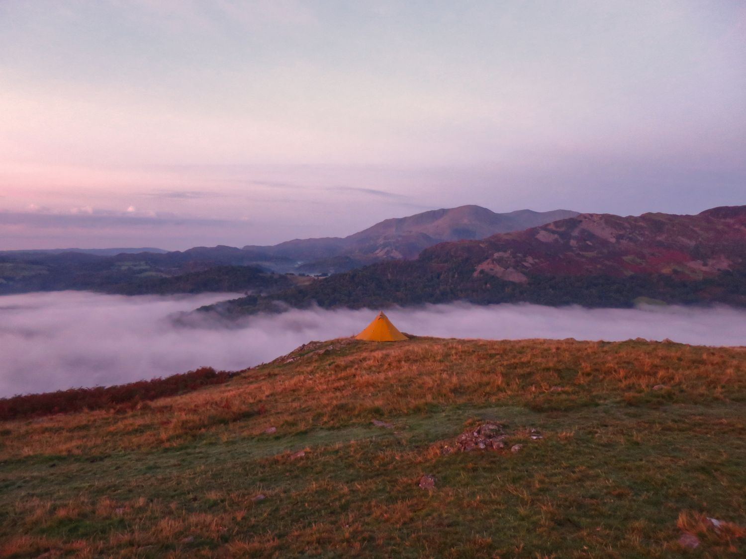
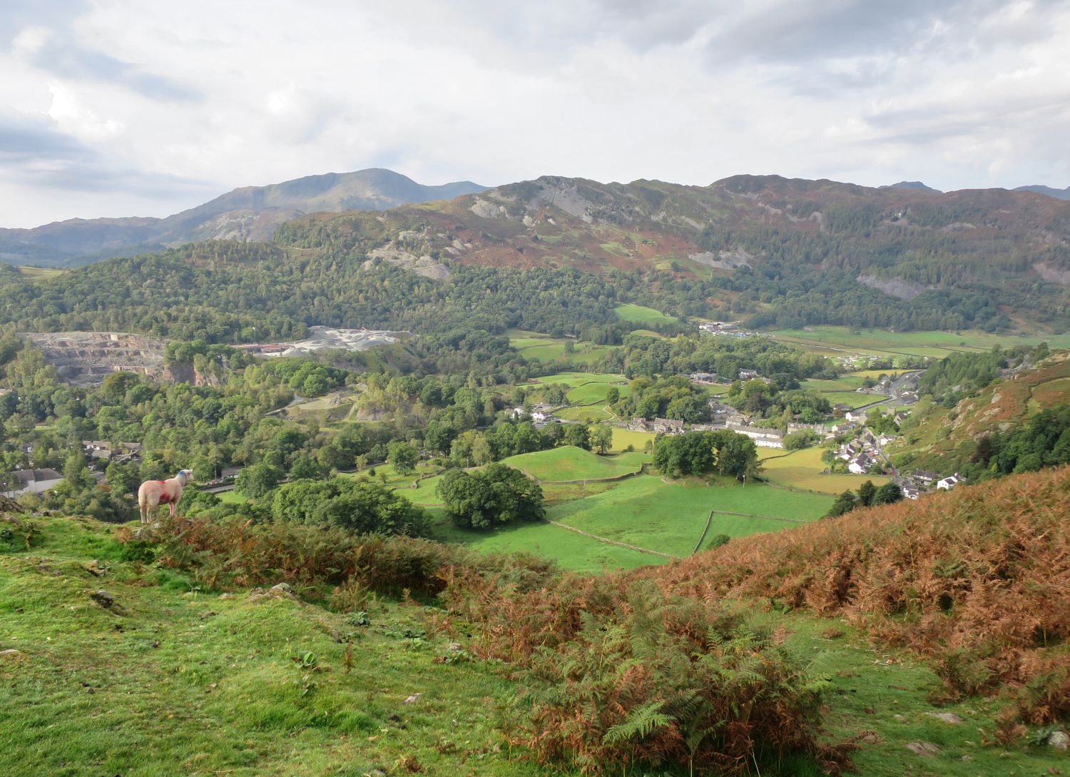
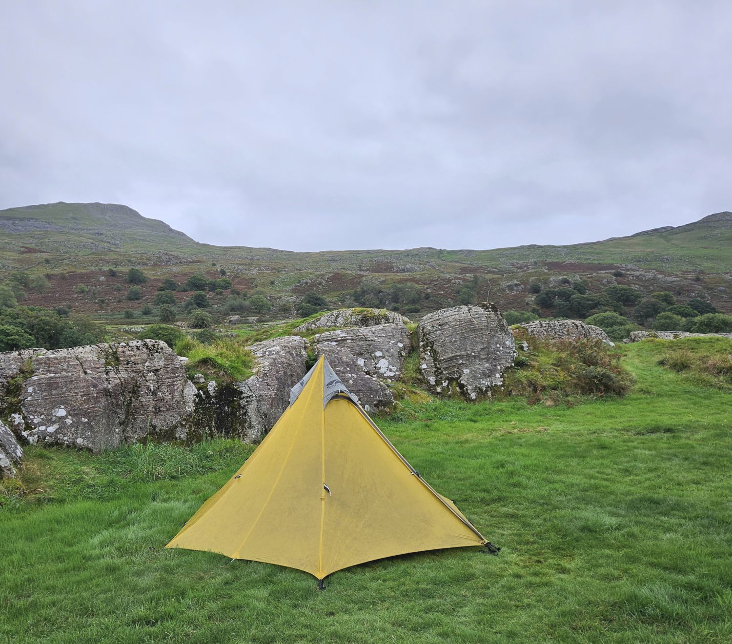
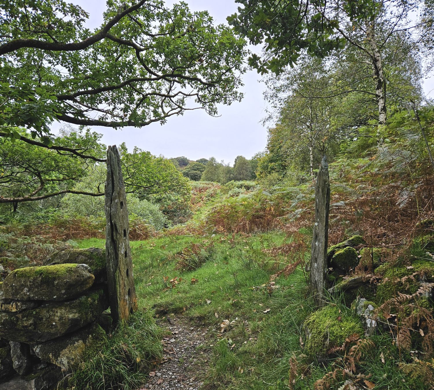
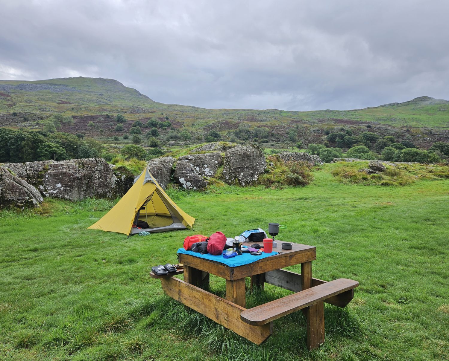
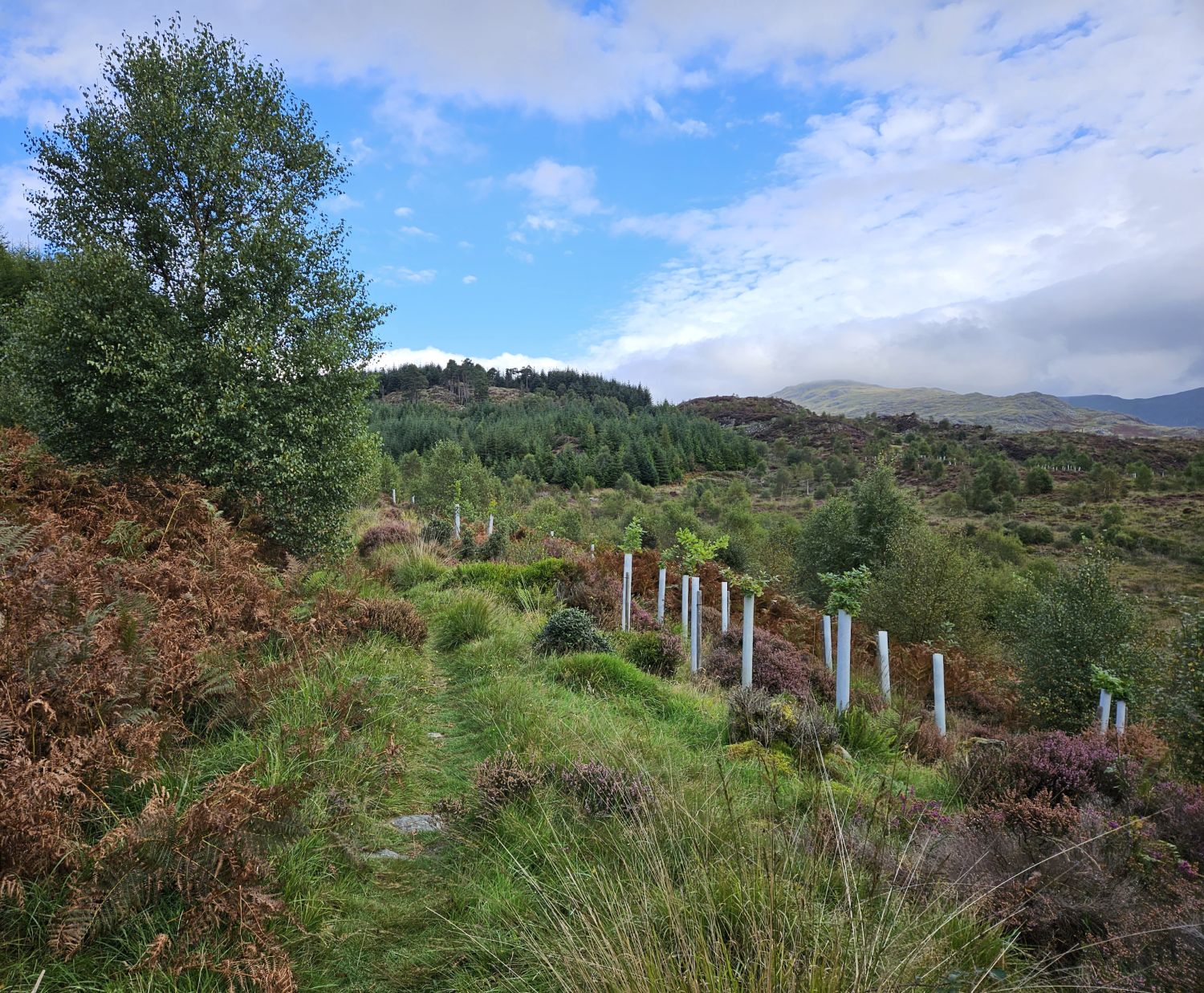
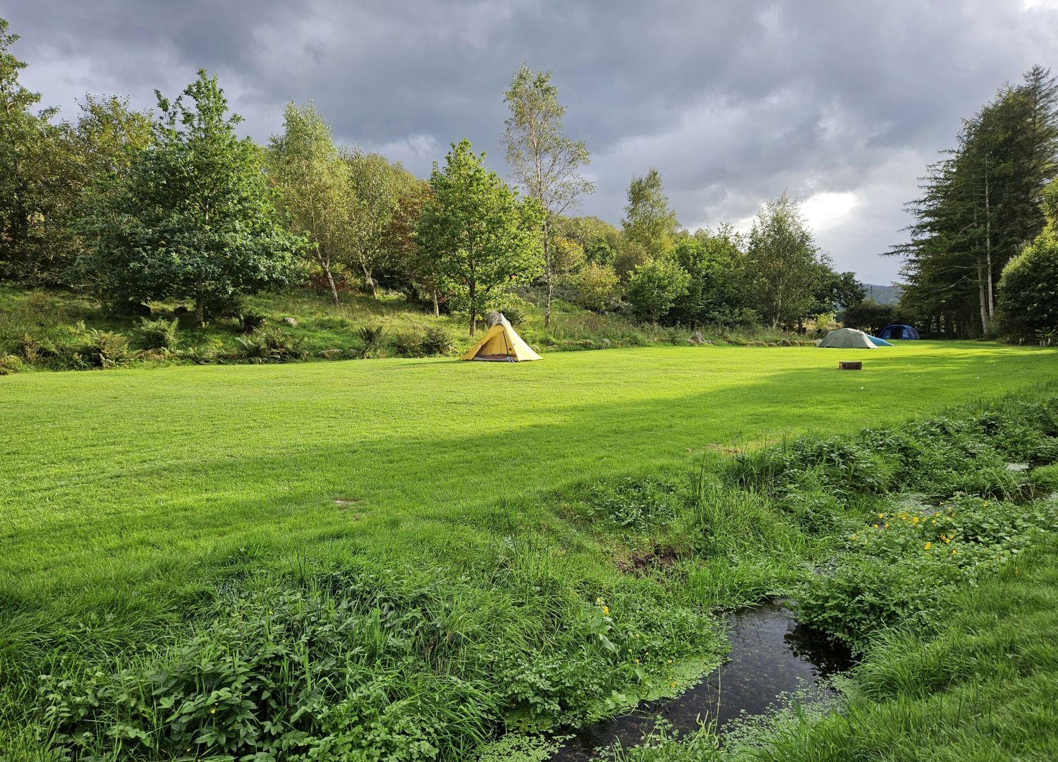
I’ve just gone over to the main summit of Dow Bank before getting on with packing my gear. Can you spot the tent over on the right? It’s certainly catching the sun this morning, which is a nice change from previous mornings, so it should be much lighter to carry today.
09:00
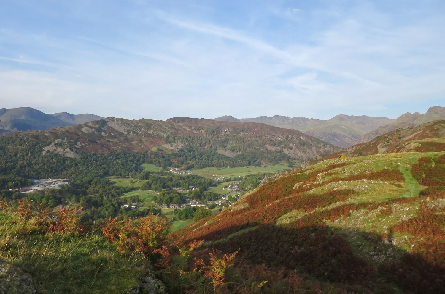
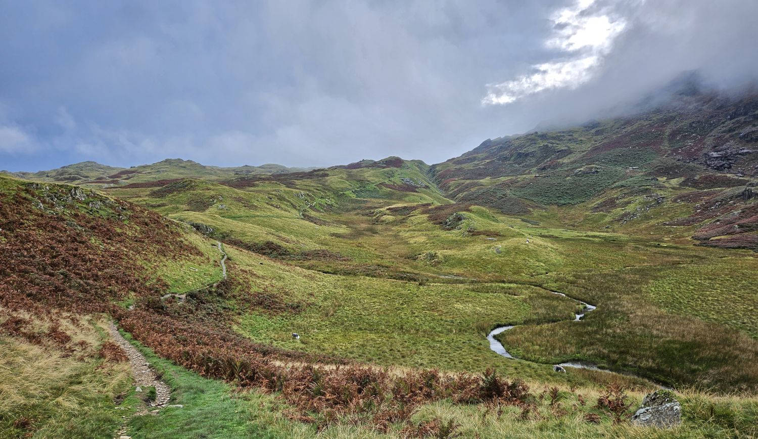
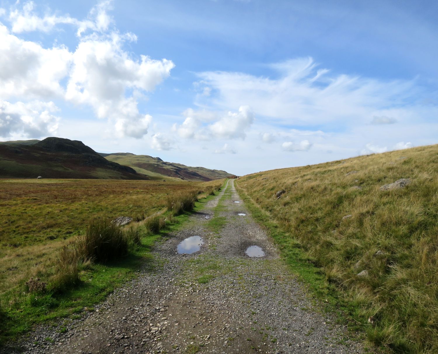
I’m now starting my descent from Dow Bank to the village of Chapel Stile, which you can see in the photo down on the right. This is a very steep drop from the col, so it’s best to take my time, especially with having this heavy pack. Look at those clouds building up though — today thunderstorms are predicted, so I’ve got my waterproofs handy at the top of my pack.
09:45
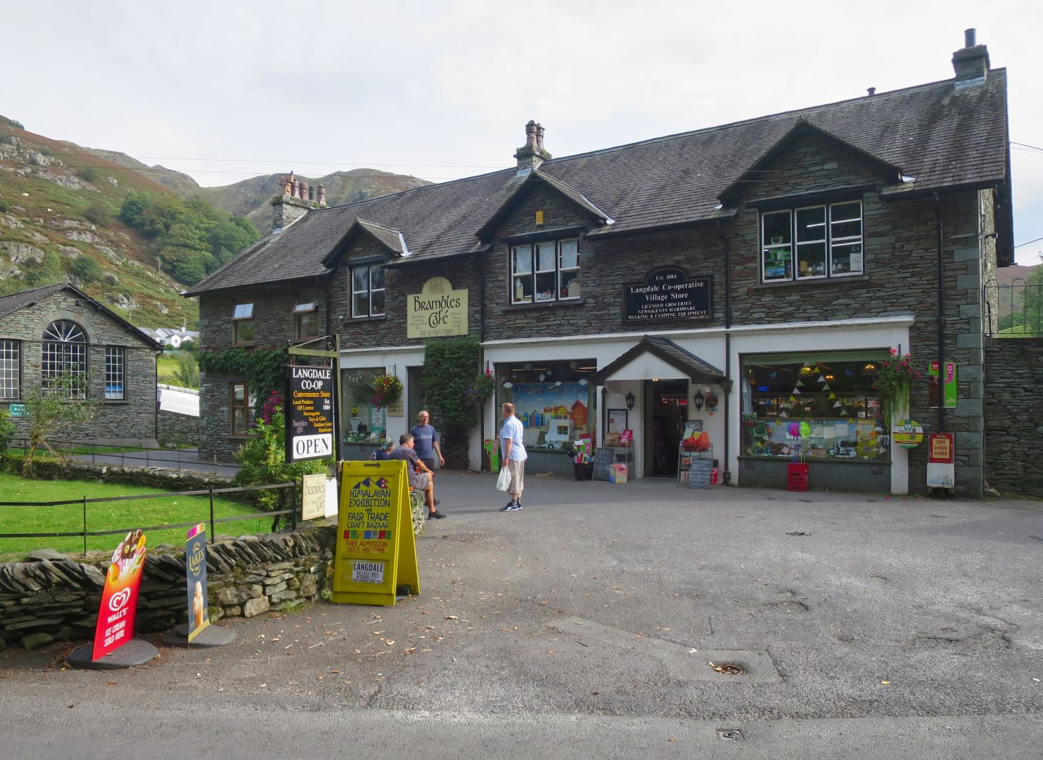
I’ve just arrived at the village shop and café in Chapel Stile. This is a great opportunity to replenish my stock of snacks for the next few days.
It’s only taken me 50 minutes to leave my pitch on Dow Bank and be sat here looking at this masterpiece!
11:45
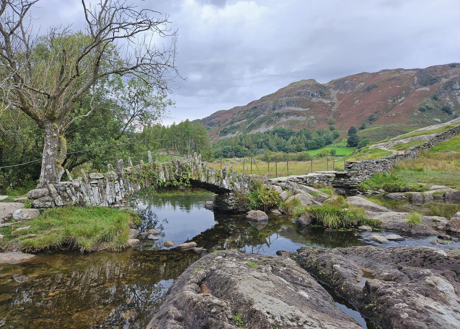
I didn’t take many photos on the next section of the walk. With plenty of fuel in the old belly, and the thought of a serious downpour later, I decided to push on at a faster pace through the next village of Elterwater and into the neighbouring valley of Little Langdale. I’m now at the iconic Slater Bridge, which spans the River Brathay. I had received some drizzle from the heavens as I left Elterwater, but it’s eased off now.
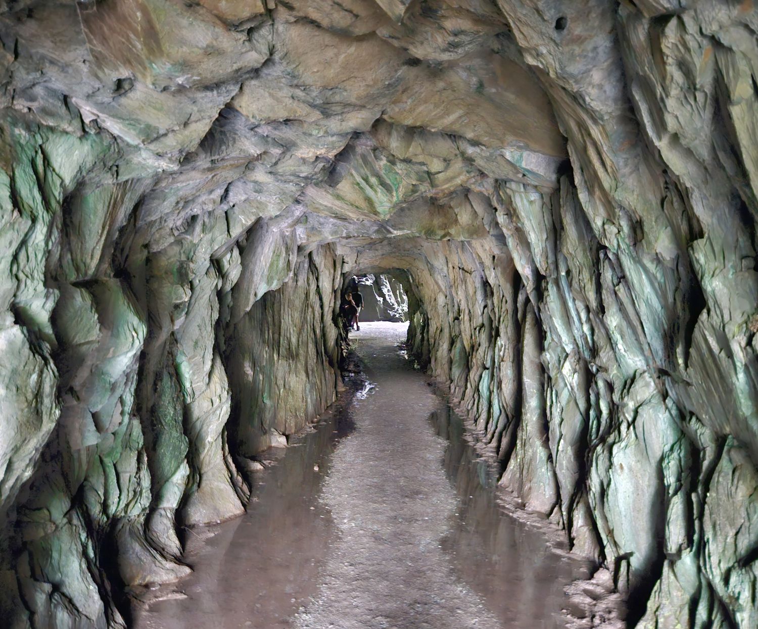
I spoke too soon — the rain started again as I approached the entrance of Cathedral Cave. That was good timing!
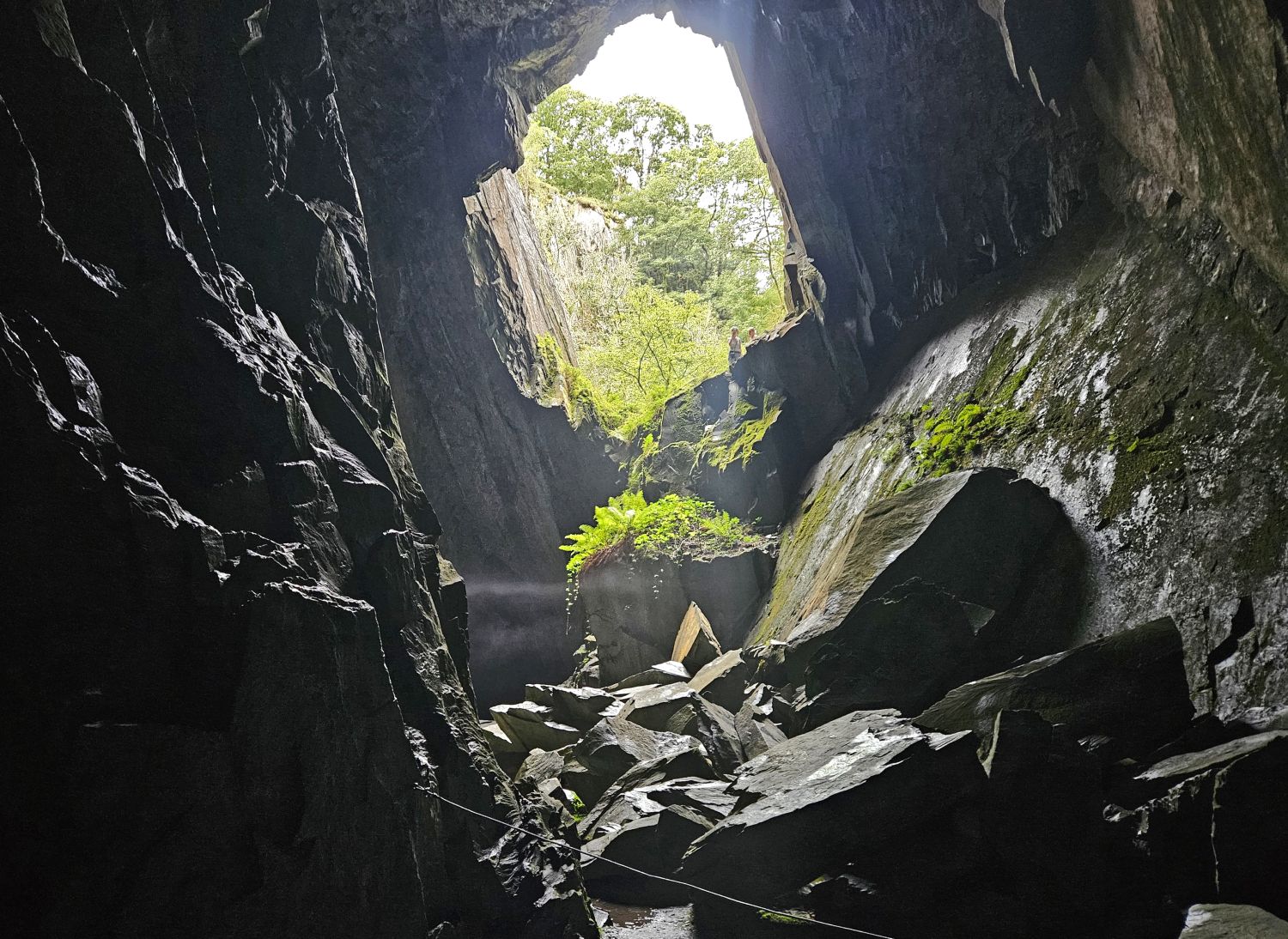
It wasn’t long until I had this huge cavern to myself. What a spooky place it is. Anyhow, I must head out and brave the elements. It sounds biblical outside!
12:45
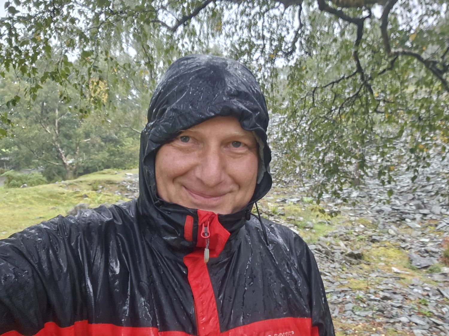
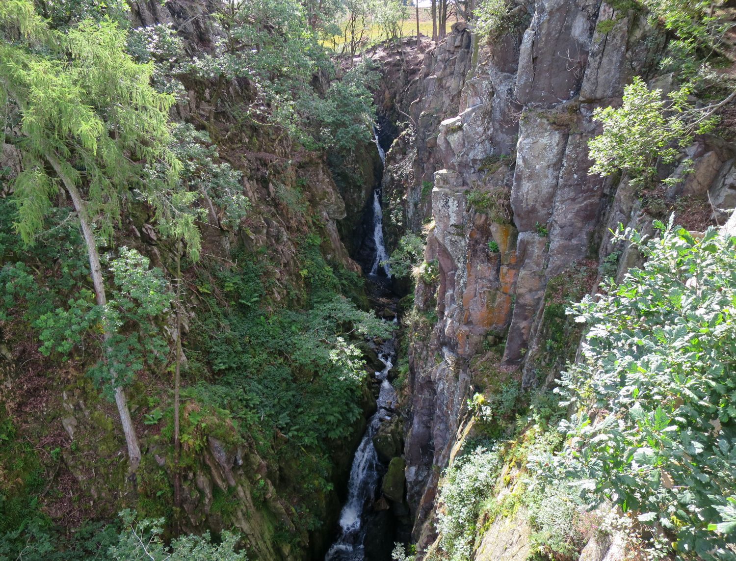
As predicted, I got caught up in the thunderstorms. Just after leaving Cathedral Cave in Little Langdale, the lightning started above me, and then came the heavy stuff. Here I am, totally drenched at Hodge Close. I’m loving it though; it’s actually a nice change from the heat and the sun, and also being able to just concentrate on the ground underfoot and simply crack on.

13:45
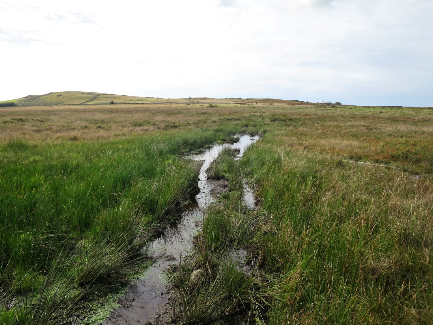
The heavy rain lasted for about two hours, but it’s now stopped as I traverse above Tilberthwaite Gill. What fantastic scenery this is in these conditions.
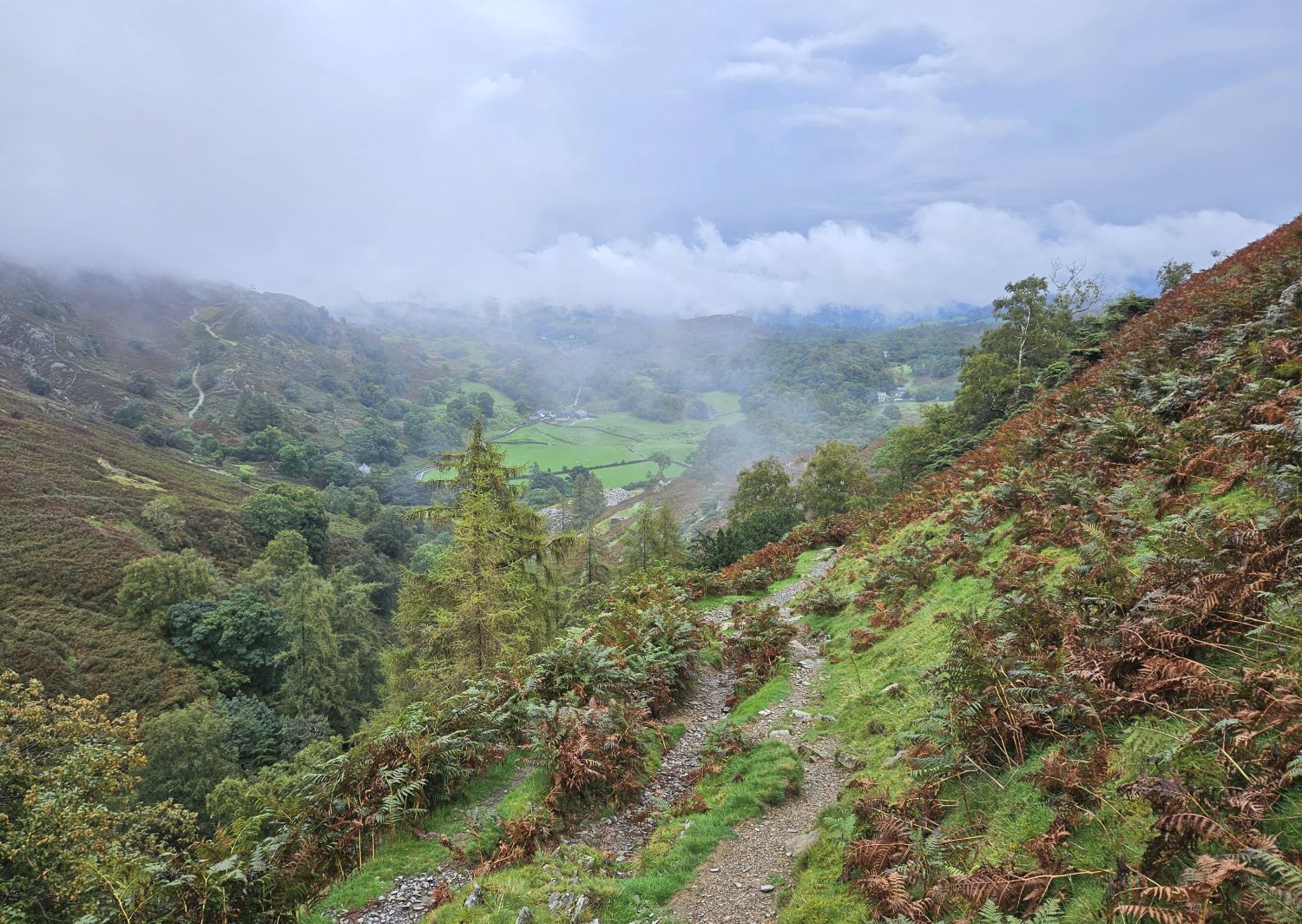
It’s very atmospheric looking back and seeing the route I had taken through the valley of Tilberthwaite.
14:25
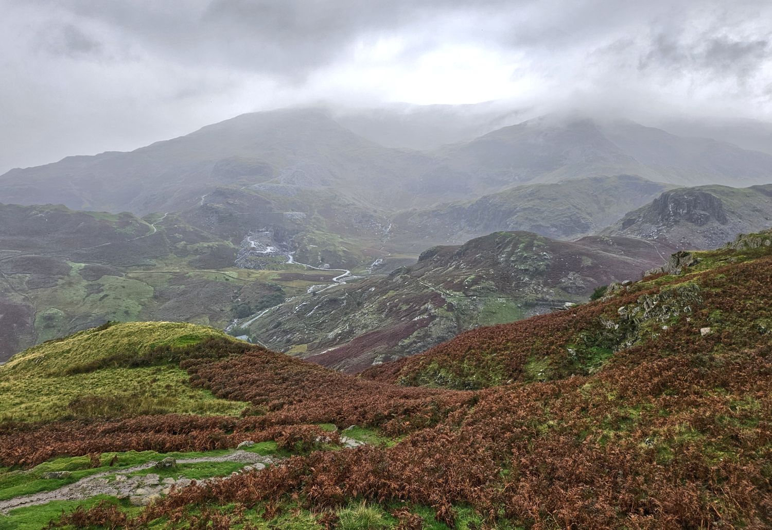
I’m now on the miners’ path and heading to the mountain pass of Hole Rake, which is the highest point of today’s walk. There are more storm clouds heading over from the Coniston Fells, so I’d best brace myself once again.
15:00
I’ve just started my descent into the Coppermines Valley, and as predicted it’s started with the heavy stuff again. This section is very steep and rocky, and will be treacherous in these conditions, so I need to take care. There’s no rush — I’ve made good progress so far, and I’m already soaked to the bone, so there’s no room for complaining.
16:30
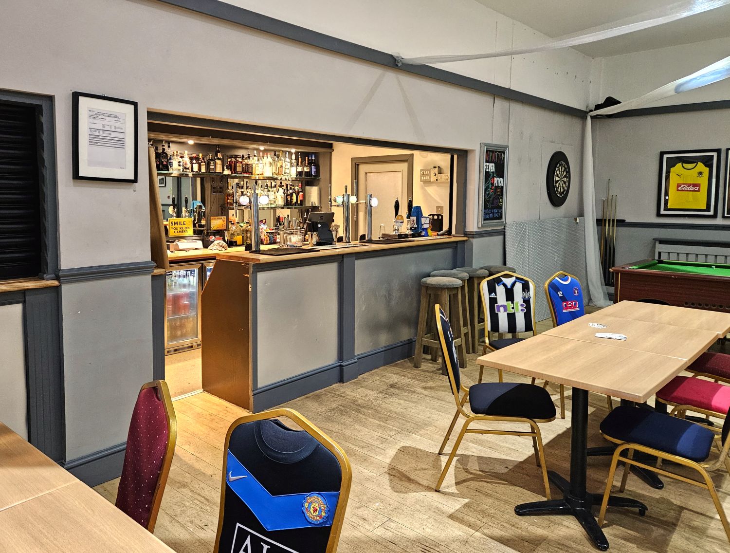
I’ve made it to the social club, and I’m alive. Well, I’m soaked to the undercrackers and in desperate need of a coffee, but I’m safe — that’s the main thing.
The look on the young lad’s face when I walked in! I initially wouldn’t go into the bar area due to being so wet and seeing the laminate flooring throughout, but the lad insisted and brought me a plastic chair to drip from. He was brilliant, and continued to look after me through the evening, providing towels and gallons of coffee and juice. I cannot thank the club enough for putting up with me and providing such wonderful hospitality.
17:45
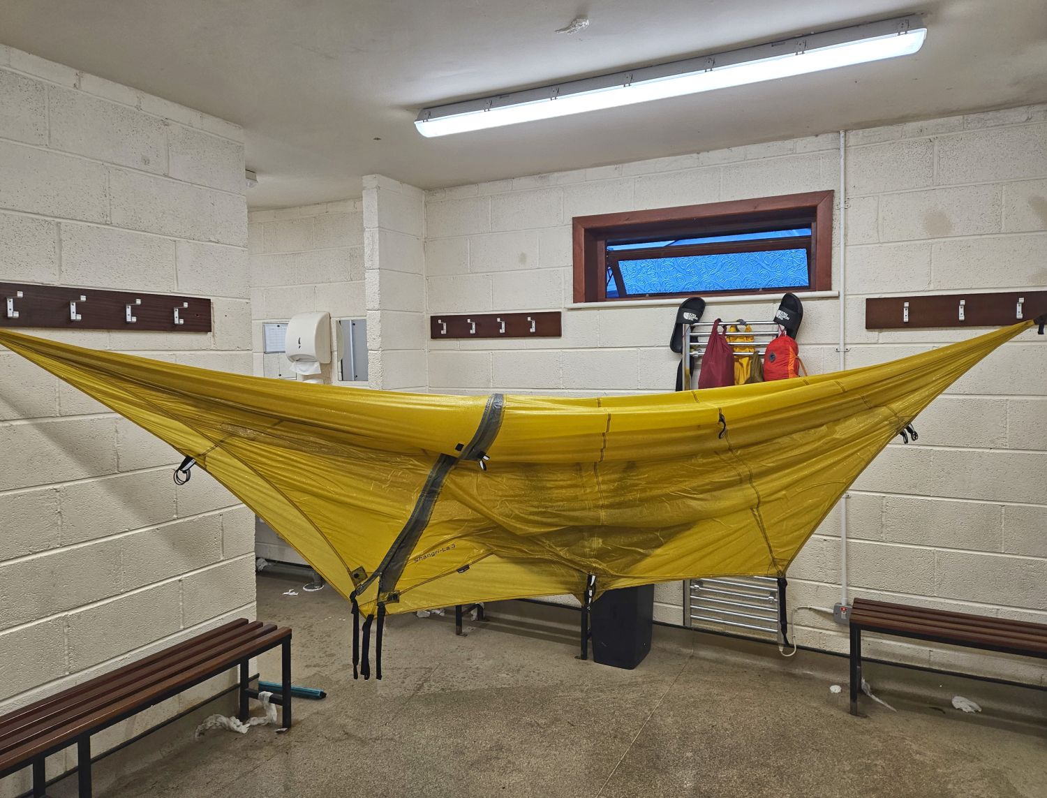
The rain continued for the next few hours, and with the thought of it getting even heavier, I needed to get the tent pitched. This was tricky because my tent system is ‘inner first’, so the inside will get wet. Thanks to my new friend behind the bar, who provided me with more towels, I was able to dry the inside of the inner before sorting my gear out.

19:30
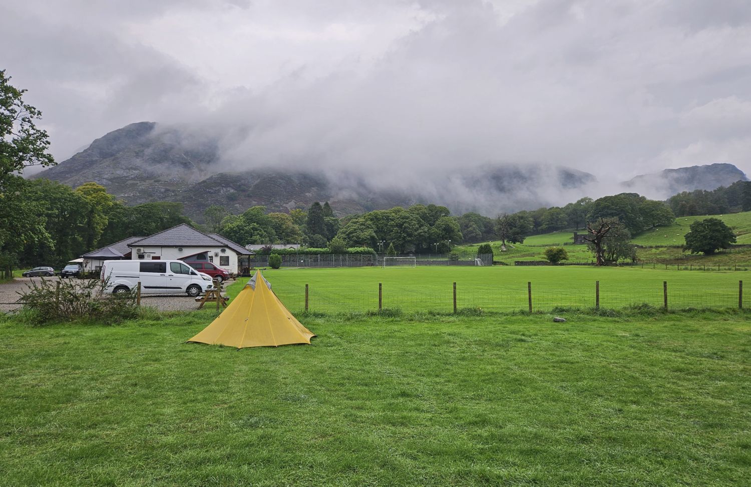
After sorting my bedding out and having a very hot shower, I headed into Coniston for an Indian takeaway. Thankfully the rain hadn’t got any worse, so I’m now able to enjoy the evening more comfortably under this canopy outside.
Well, that’s it for today. It was an eventful day, but I thoroughly enjoyed the experience. It’s really nice to mix the journey with wild camps, campsites, and even a football pitch. Day 9 will always be my favourite section on the Lakeland Way, due to the terrain and history connected to the area, and the way the route meanders through the valleys. It is, after all, the route that inspired me to create a long-distance path in the Lake District.
Goodnight, folks!
Monday 11th September, 2023
Day 10
Coniston Sports & Social Centre to Turner Hall Farm – 13 miles
07:00
Morning from Coniston.
Considering the drama of yesterday in the rain, which resulted in everything being saturated, I surprisingly slept very well last night. It continued to rain through the evening, but it had stopped around midnight, leaving me with a peaceful night’s sleep.
I’m now on a mission. I need to dry the fly of my tent as much as possible, so in desperation I’ve hung it in the showers of the social club. The showers and toilets hadn’t yet been cleaned from the day before — note the paper towels, including one on the ceiling! — so I’m thinking I will get away with this before the cleaner arrives. In fact, I will give it a good mop before I go. The single radiators — one in the men’s and one in the women’s — had provided a good opportunity to dry all my other gear through the night, including my jacket, fleece, socks, etc. All that is left on the radiators this morning are my flip-flops and a few dry-bags.
07:40
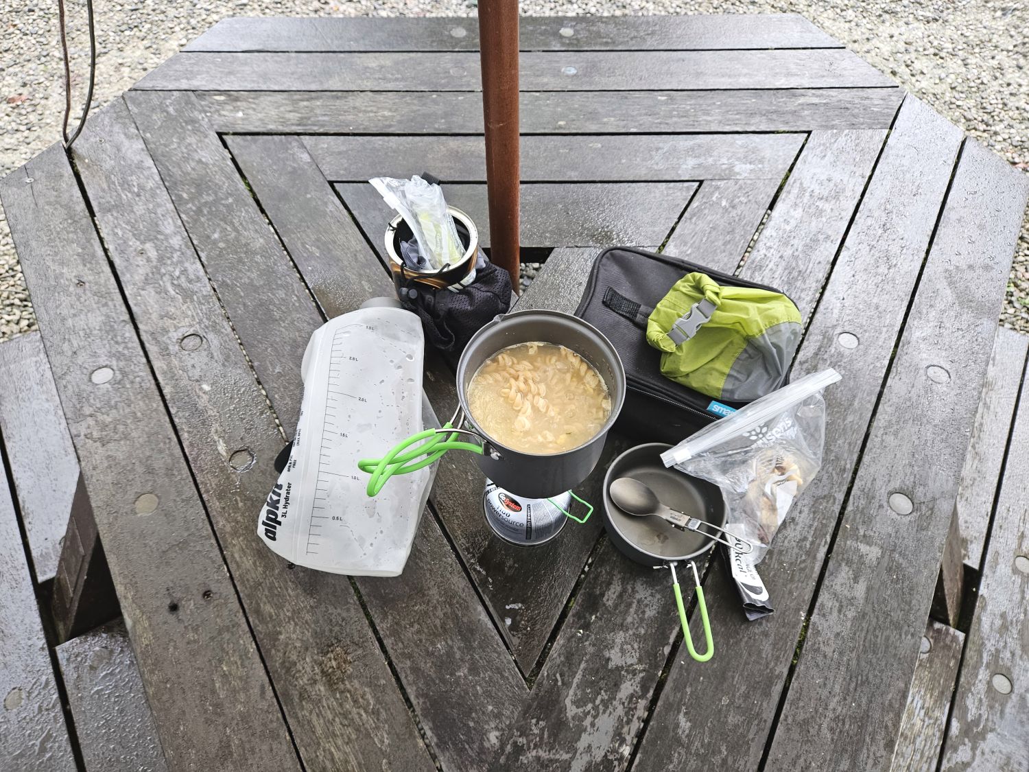
One of the benches outside the club provided me with a good, stable area to cook and eat breakfast. It is soup and pasta again, but this will be the last time. For the final two mornings I will be enjoying the delights of a full English. There were no other campers here last night, so I had the showers, toilets, and these benches all to myself.
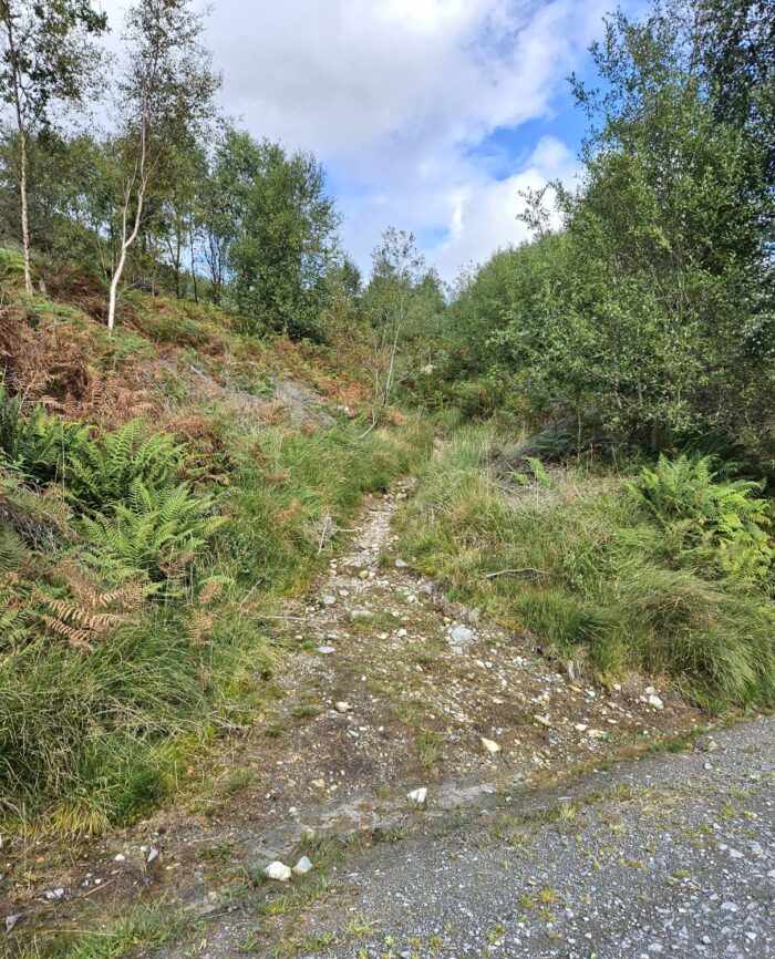
08:45
I left the club at 08:30, and after a short walk through the village of Coniston I’m now heading towards the Coppermines Valley. My tent is still saturated, so my pack is quite heavy. That is the downside of having a nylon fly and not a polyester one, so I’ve learnt my lesson for any future long-distance hiking.
09:00
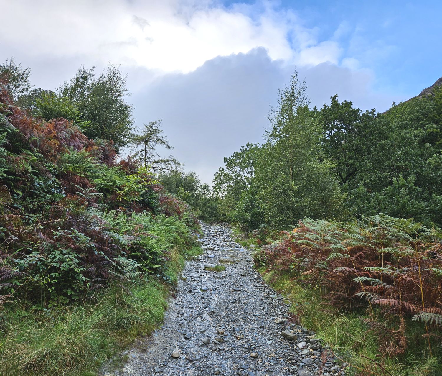
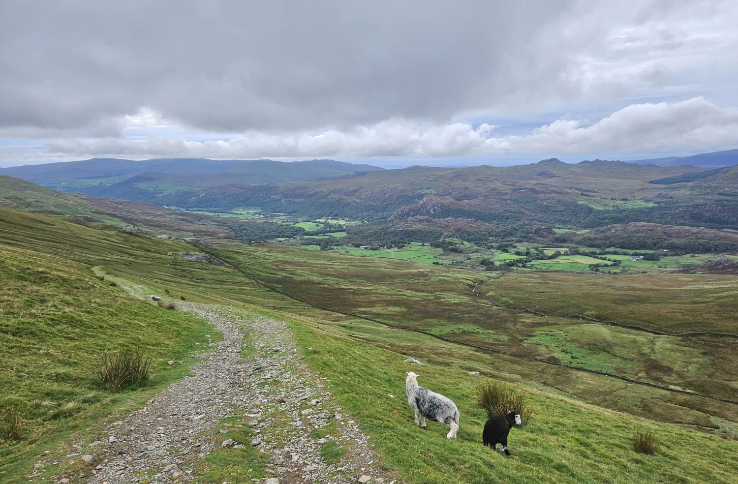
I’m now entering the Coppermines Valley, which is certainly the highlight of today’s walk. It is 11 miles to Seathwaite from Coniston and there’s much to see along the way, so it’s best to give yourself plenty of time. Without doubt, this section of the Lakeland Way will be a favourite for many.
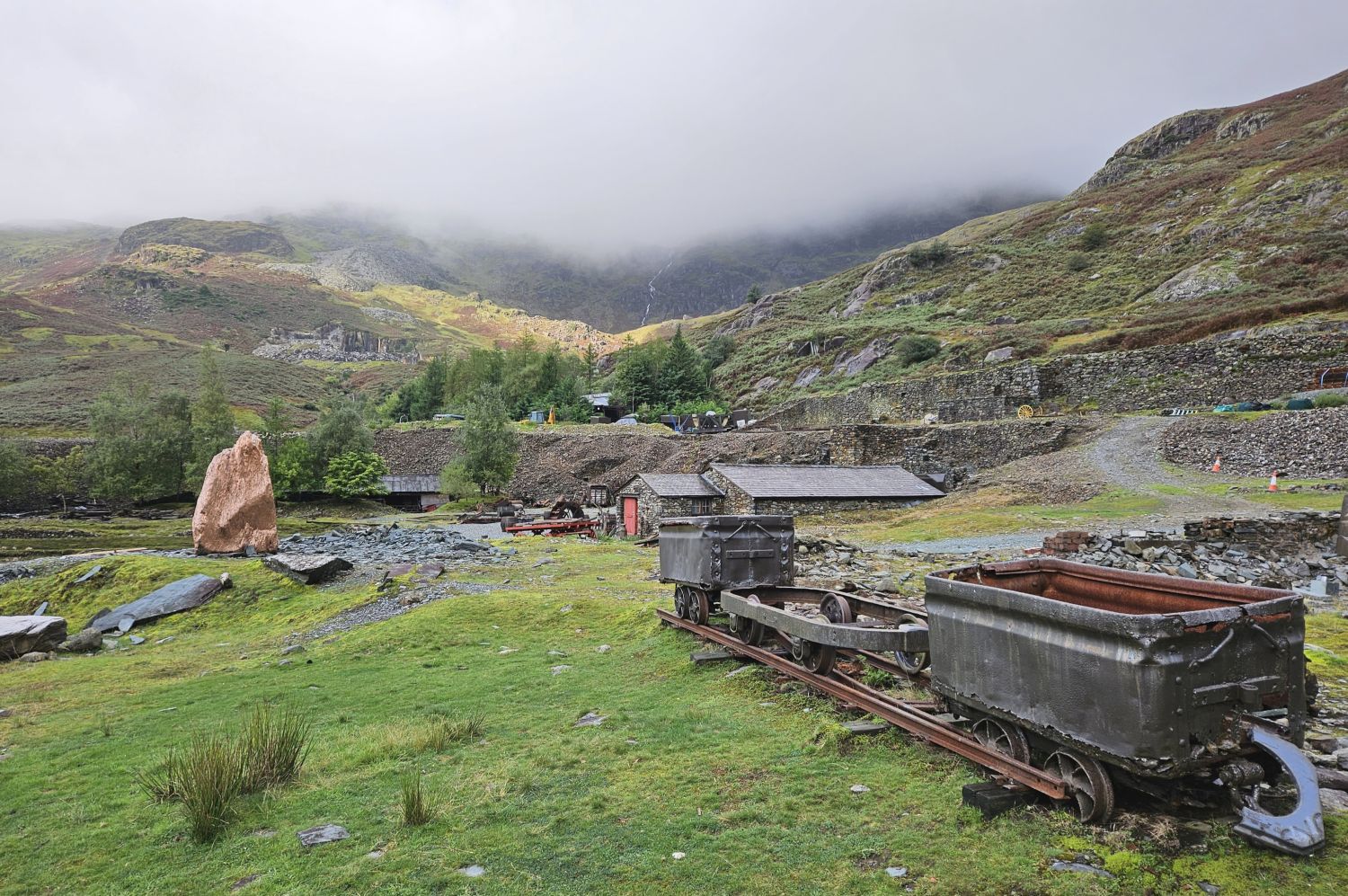
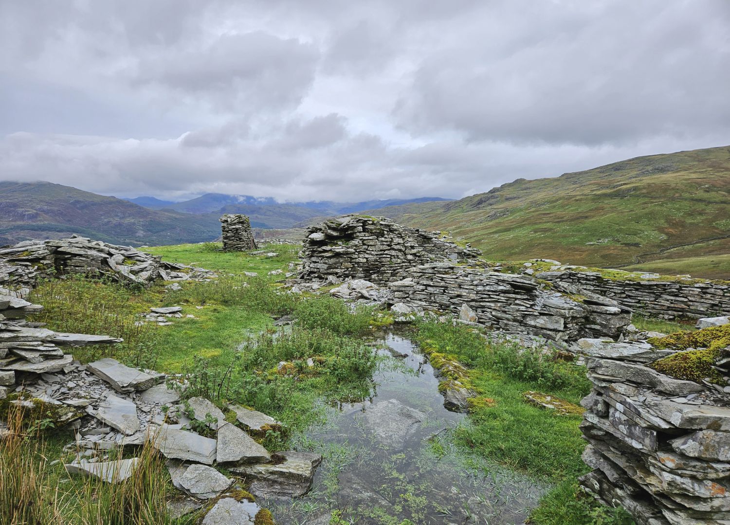
If you have the time, then please have a wander around the old mine workings in the heart of the valley. The Bonsor Upper Mill area is a museum of relics from a once-booming industry.
I’m now at the base of my first steep climb of the day, so I took the opportunity to rest beside the gushing cascades of Red Dell Beck and admire the surroundings. Looking back, I can see the sun trying to brighten up the valley, but I feel these will be rare moments as the forecast is for a very cloudy day. It is not raining and the air is very still, and I’ve not seen another person since leaving Coniston, so it feels eerie yet peaceful. I’m certainly feeling the loneliness and starting to crave some company.
09:40
After a short, steep climb I’m now in the upper valley of Red Dell. Ahead I see Kennel Crag looking formidable, and on its right flank the Thriddle Incline — a steep, narrow scree chute leading directly to the ridge and into the upper cove of Levers Water.
There is only one method used on this climb, and that’s look down, take a few steps, turn around, and admire the view. Look down, take a few steps, turn around, and admire the view. And so on….
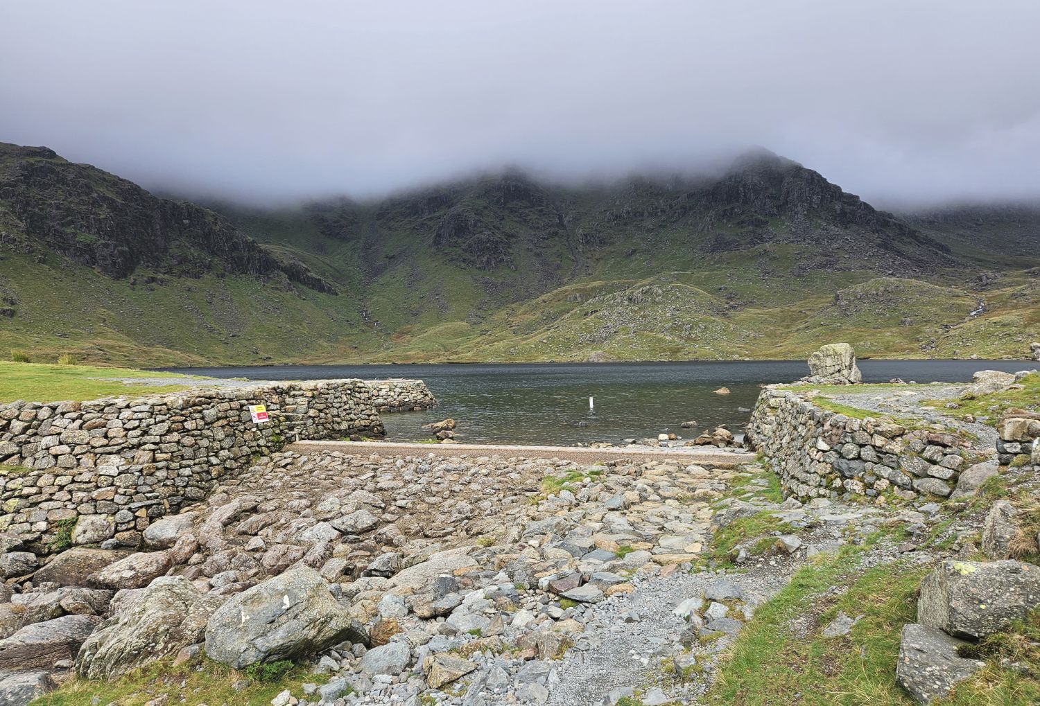
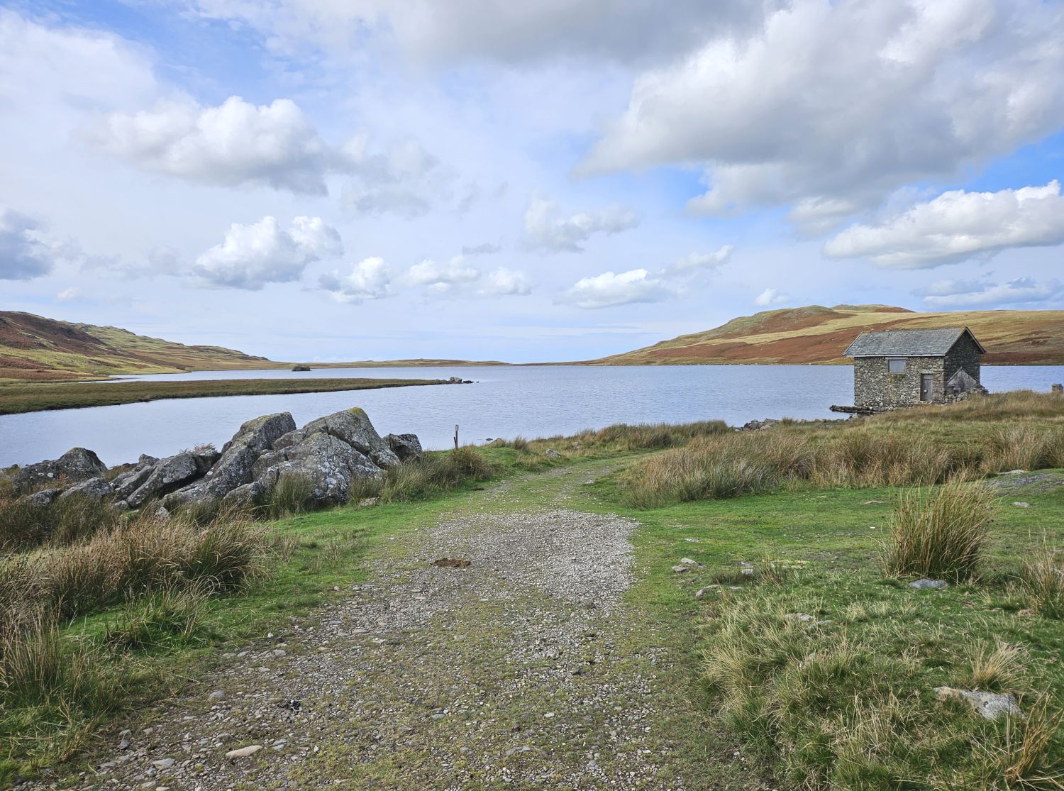
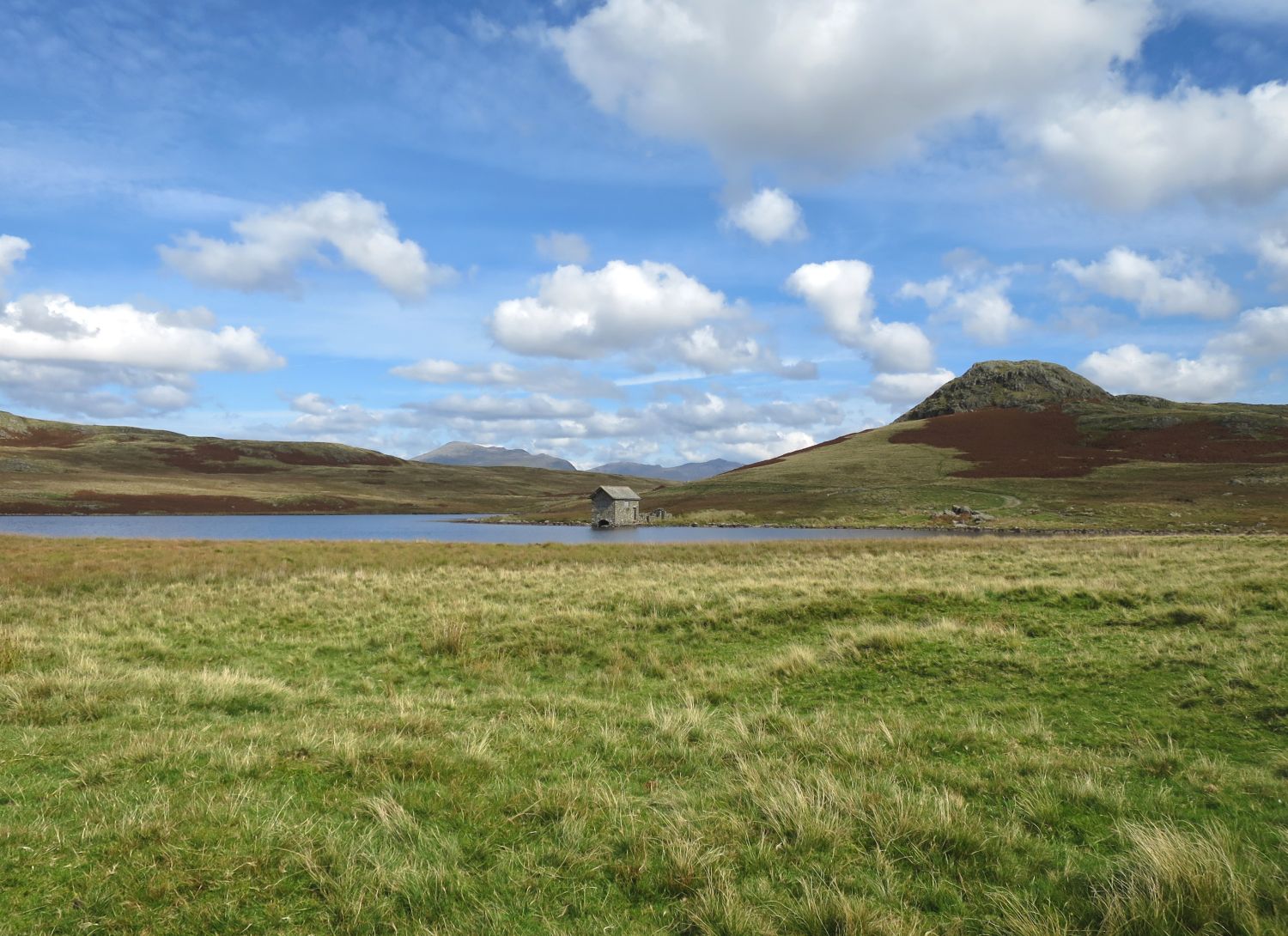
10:00
I’ve finally reached Levers Water in the upper cove. Although it has been beautiful scenery throughout, I’m so glad that last climb is accomplished. While there is far less steepness to come, the tracks are rough in places and the ground is still very wet, so I need to take care.

I’ve just stopped at Crowberry Haws to look back and admire the scenery. Wow! The loop around the Coppermines Valley is a special part of this section and is certainly worthy of inclusion on the Lakeland Way. Not just for its beauty, but also for its history.
12:00
Although I really enjoyed the Coppermines Valley loop, I’m really glad to reach Walna Scar Road, where initially it’s an easier track to follow for some distance before it rises over into the next valley. Here I’ve stopped at Torver Bridge to filter some water.
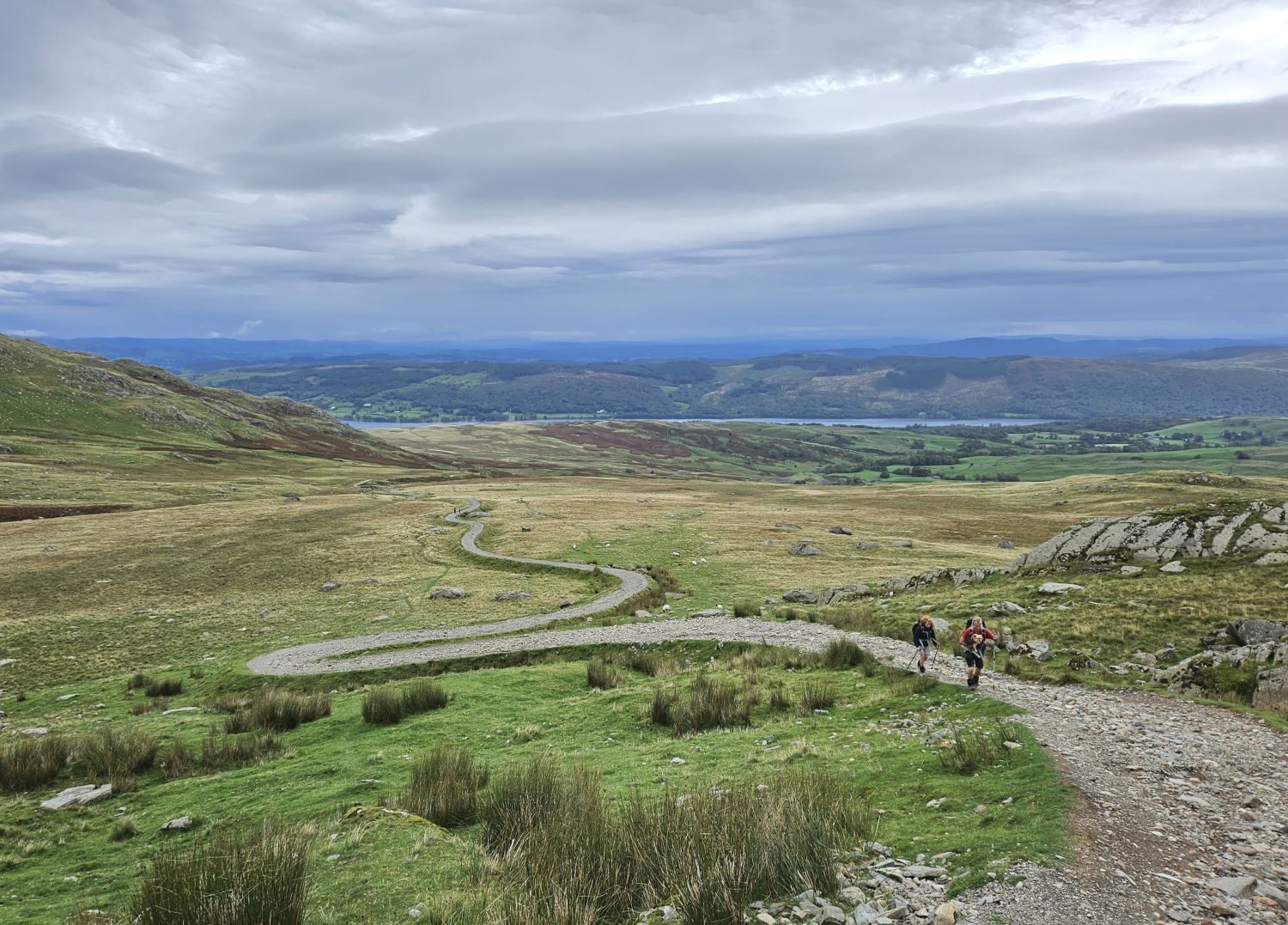
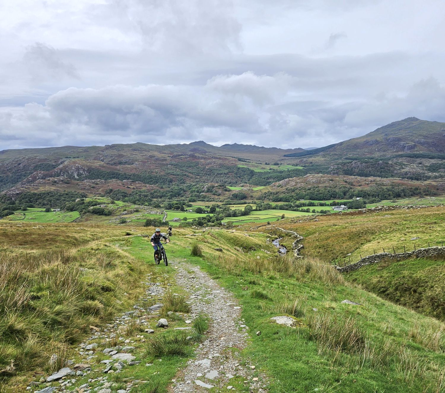
Due to my early start from Coniston I didn’t see another person in the Coppermines Valley, but as I ascend the steepest section of Walna Scar Road my progress is slowing, and walkers, runners, and bikers are arriving behind me and passing in numbers.
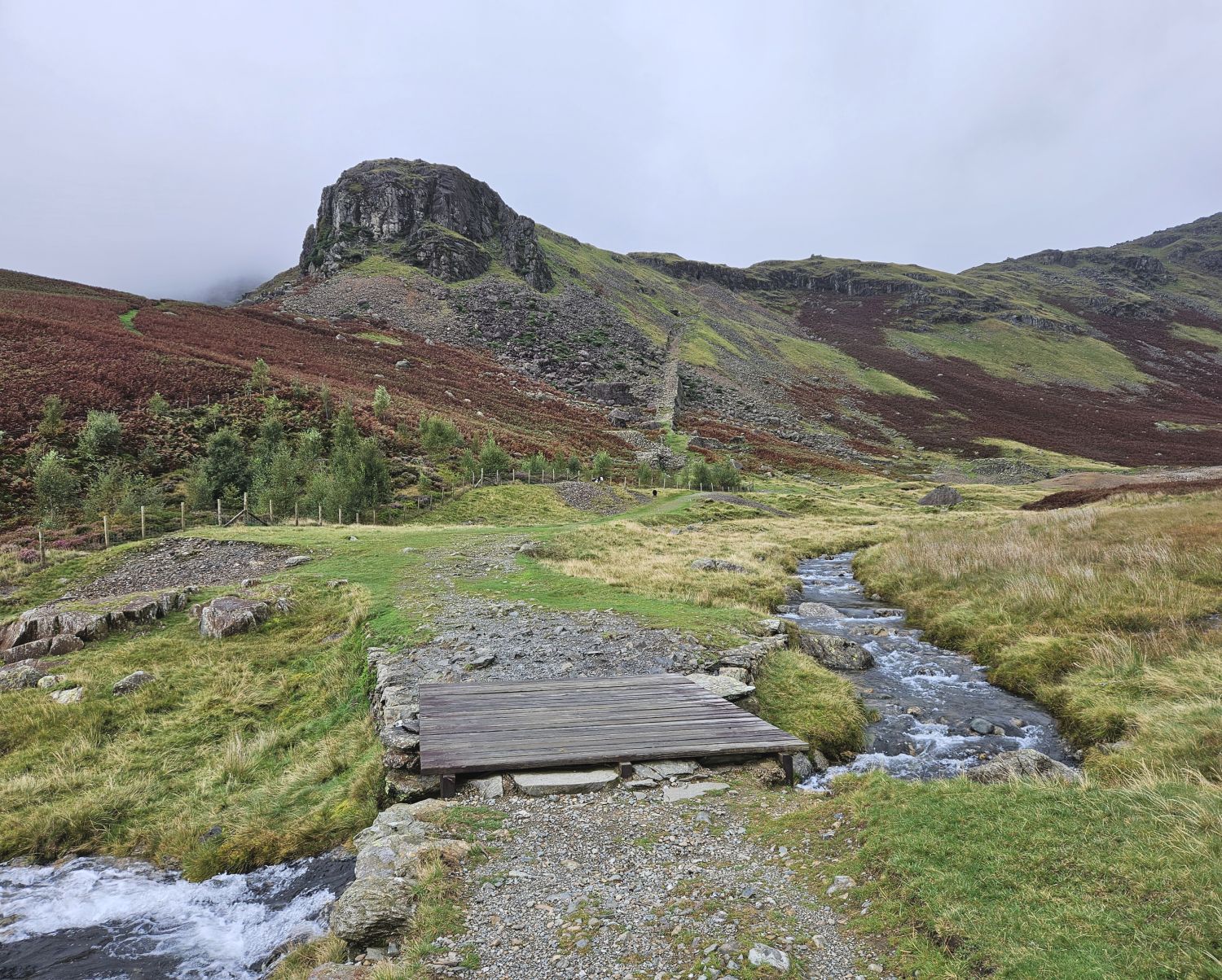
12:40
I’ve just arrived at the little shelter near the summit of Walna Scar Road for a short rest. Although it did take 40 minutes to climb that last mile of rough track, I’m happy with the time at this point of the walk. There is still some way to go, though.
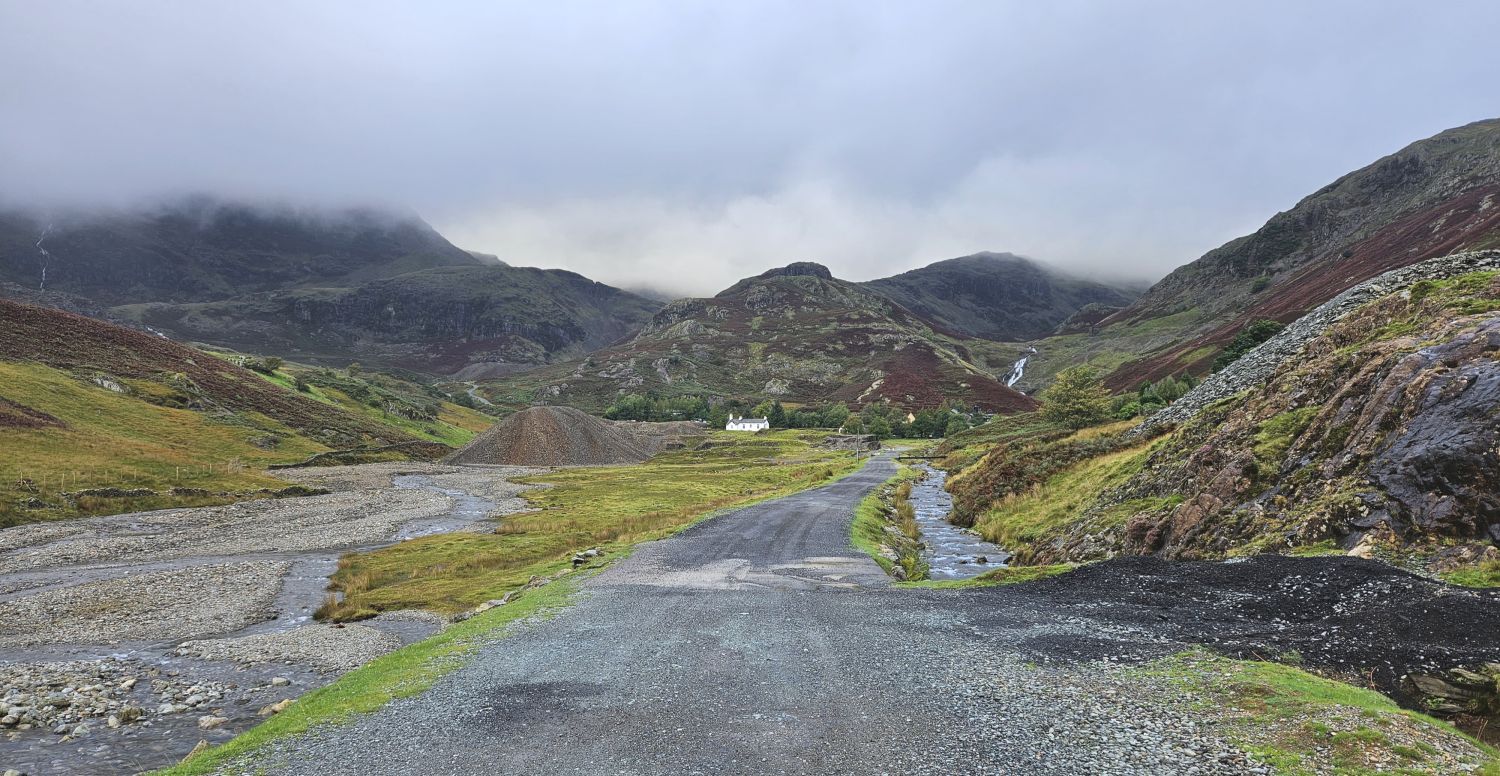
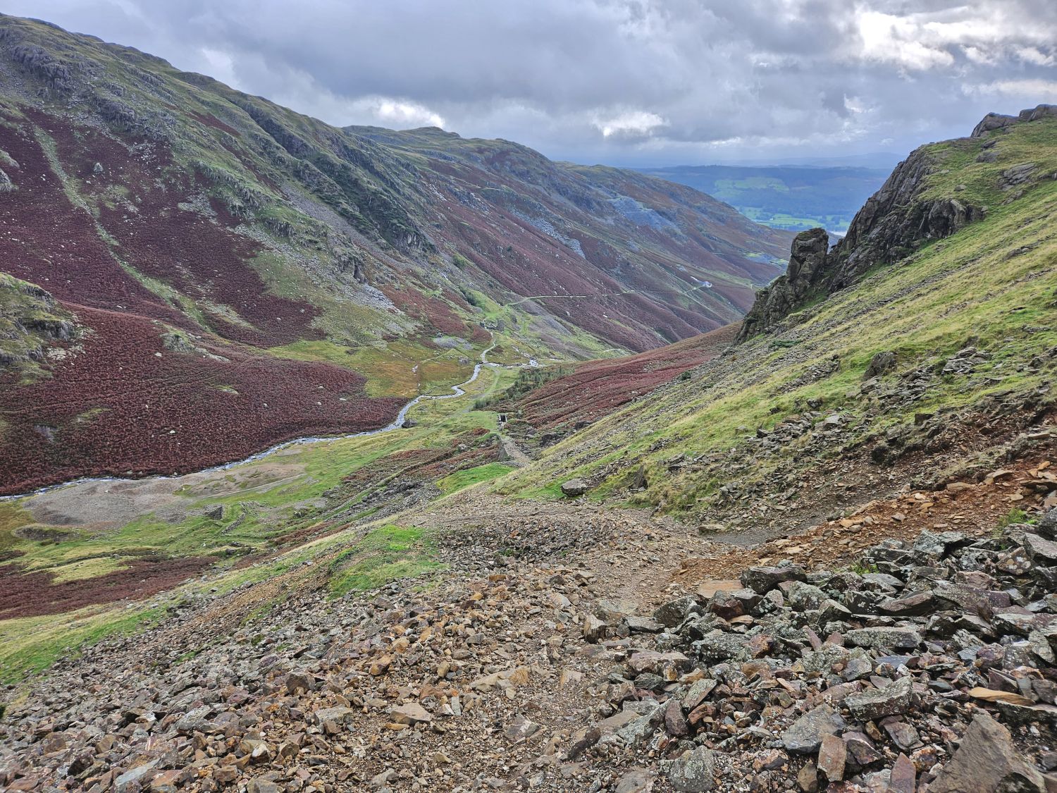
It’s nice to be dropping down into the Duddon Valley — I can just about see the whole of the second part of the route as it descends its way down to the hamlet of Seathwaite. Walna Scar Road is much easier now as it leads the way to the old quarries, so I can make good progress.
I decided to take the short diversion to visit Walna Scar Quarries, which is recommended if you’ve never been before — and if time allows, of course.
13:30
I’m back on Walna Scar Road now. From this point on, it’s a final descent to the valley bottom, and the track becomes rough, which slows progress.
A clever decision was made here — I know, it doesn’t happen that often. On reaching the valley bottom, I will divert and take the shortcut to Turner Hall Farm to pitch the tent and dump all my gear. I will then retrace my steps back to the Lakeland Way path and continue on down the gorge and to the Newfield Inn for dinner. I then only have a short walk up the road back to the campsite afterwards.
It was no surprise to see the tent still saturated. All that extra weight from Coniston!
I’ve just had a nice hot shower and put on some fresh clothes — I’ve even used my Alberto “Coconut and Lychee” conditioner and Lynx “The G.O.A.T. of Fragrance” antiperspirant that I bought at Sykeside Campsite in Patterdale. Crikey, that seems so long ago now!
16:10
I had a good hour and a half at the campsite and didn’t leave until 15:30, but I still have plenty of time to enjoy the rest of the walk. I’ve now crossed the valley bottom and I’m on my way to the start of Wallowbarrow Gorge. It feels rather strange and uneasy not having a rucksack on my back, though my body will soon adapt to it.
On reaching Fickle Steps it was nice to see the River Duddon so low — I didn’t fancy swimming across and washing off my new fragrance!

16:30
I’m now on the right-hand side of Wallowbarrow Gorge and just about to start the descent to Seathwaite. This narrow path is slippery and steep in places, so I need to take care. There is no rush at all and it’s much easier without all the weight on my back.
I had the gorge all to myself, and with it being so narrow and enclosed it felt a bit creepy at times. I certainly wouldn’t want to walk through in the dark.
18:15
I arrived at the Newfield Inn at 17:15, so the two miles from the campsite took me an hour and 45 minutes. That may seem very slow going, but the gorge can be dangerous and there are many obstacles along the way: stiles, narrow ledges, boulders, etc. With that in mind, in really damp conditions it is recommended to take the alternative route and walk down the road to the pub.
I’ve just been served my meal, so it’s time to tuck in. I’ll say goodbye now and will catch up with you in the morning.
Tuesday 12th September, 2023
Day 11
Turner Hall Farm to Eskdale National Trust Campsite – 11 miles
Morning.
08:15
Well, that was a nice, welcomed rest compared to previous nights on this trip. Because I had pitched the tent earlier in the afternoon yesterday, everything inside was already organised when I returned from the pub. Plus I had already eaten, so I settled down straightaway and fell asleep around 8pm. I still had the usual stirs, etc., last night, but I stayed in there for over 12 hours.
Anyway, I’d best get moving and have some breakfast. The farmer is certainly up and busy doing his routines around the farm. I have to say though, it has been very peaceful here at the head of the valley — a really nice location to stay the night.
09.25
Although the Newfield Inn provides a hearty breakfast from 9am, I’ve chosen to eat at the campsite instead to lighten my load. As per usual, the tent is saturated and it doesn’t look like the sun is going to appear this morning.
There’s no major rush today. The walk to Boot is fairly easy; a straight hike up to Hardknott Pass, and then a straightforward descent into the next valley of Eskdale.
10:50
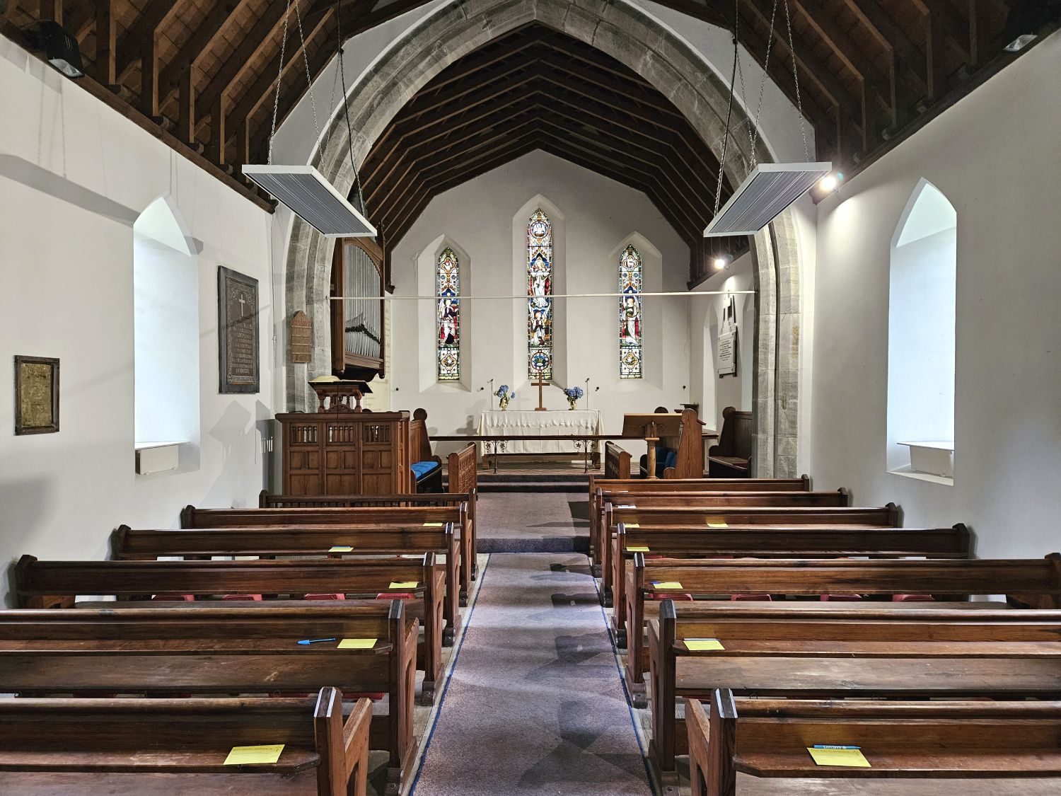
I didn’t leave the campsite until 10:30am, which is quite a lazy start for me. After a short walk down the road to the village, I soon arrived at Holy Trinity Church, where I’m now sat relaxing and admiring the interior. It was noticeably cooler this morning, so I’ve taken the opportunity to change into my trousers while in the confines of the church.
I sat in the church in total silence for about 20 minutes, thinking about life and my journey. Churches have a habit of doing that, don’t they?

11:10
I’m finally on my way properly now and just leaving the village. Even though it’s a very late start for me, as usual in this area in the Duddon Valley, there are very few people about.
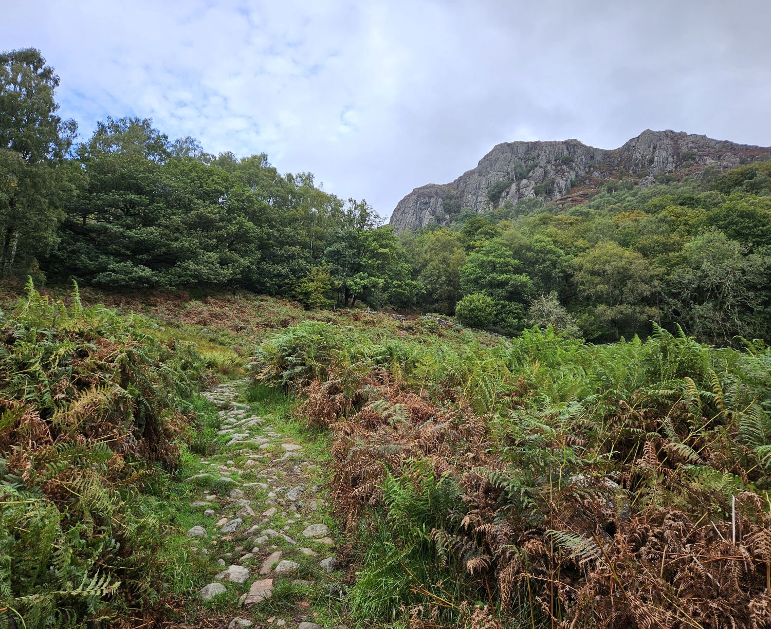
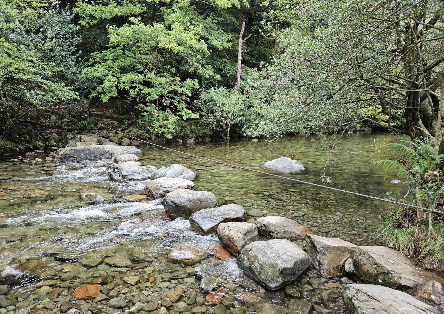
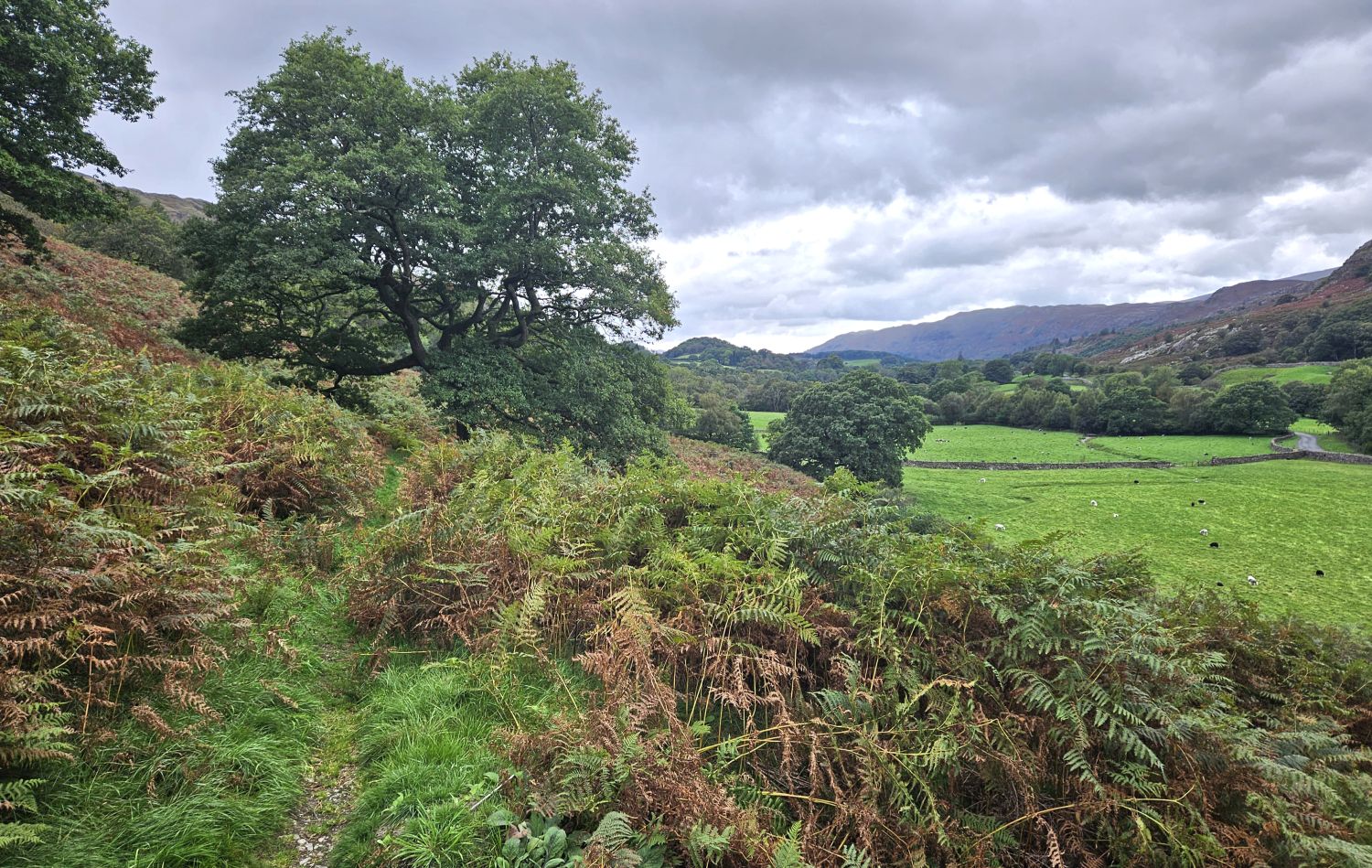
Wallowbarrow Crag is seen ahead, towering above the wooded slopes, as I ascend The Rake from High Wallowbarrow Farm. The stepping stones over the River Duddon were easy enough to negotiate, as there’s been very little rain recently.
This is my first climb, but generally speaking there are no hard climbs on today’s walk to Boot in Eskdale.
11:55
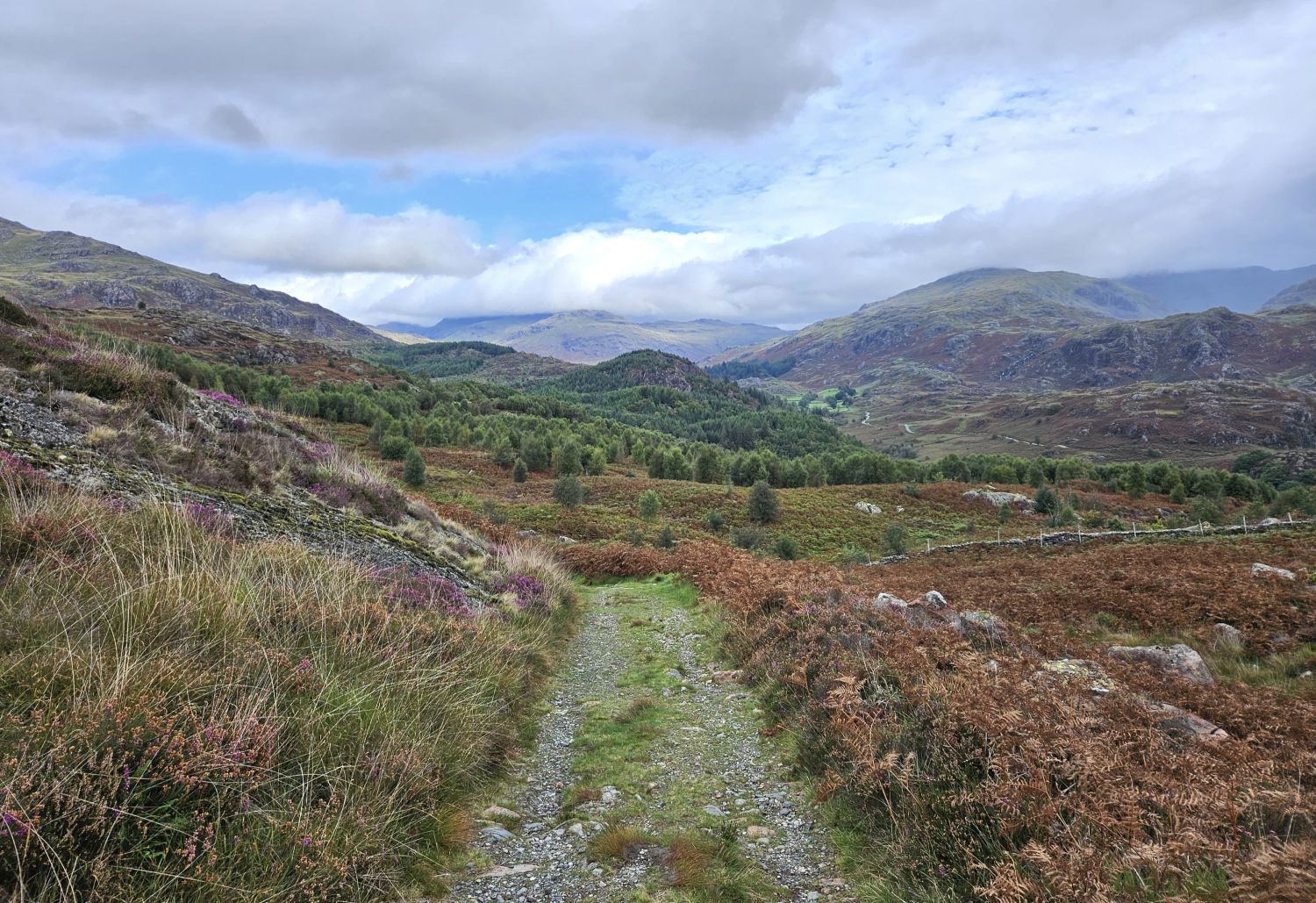
I’m now at the highest point on the track that leads to Grassguards, providing me with a glorious view up the Duddon Valley. Blue skies are now joining me and it’s becoming warmer.
This very old track from Seathwaite to Grassguards, which also passes through a nature reserve ahead, is one of my favourites in Lakeland, and one that I was so pleased to be able to include on the Lakeland Way.
From the hamlet of Grassguards, this lovely, narrow path is a delight to follow and avoids much of the forest road.

I’m now on the forest road, which I’ll only follow for half a mile or so. Buck Crag towers above on the left.
12:40
I’ve arrived at the start of my next ascent, the narrow track that climbs through the forest all the way to Hardknott Pass. This junction is very easily missed when walking along the forest road. The track is an old bridleway and, due to very few people walking this way, it can become overgrown at times. Hopefully, now that Lakeland Wayers are travelling this way, it will get more use.
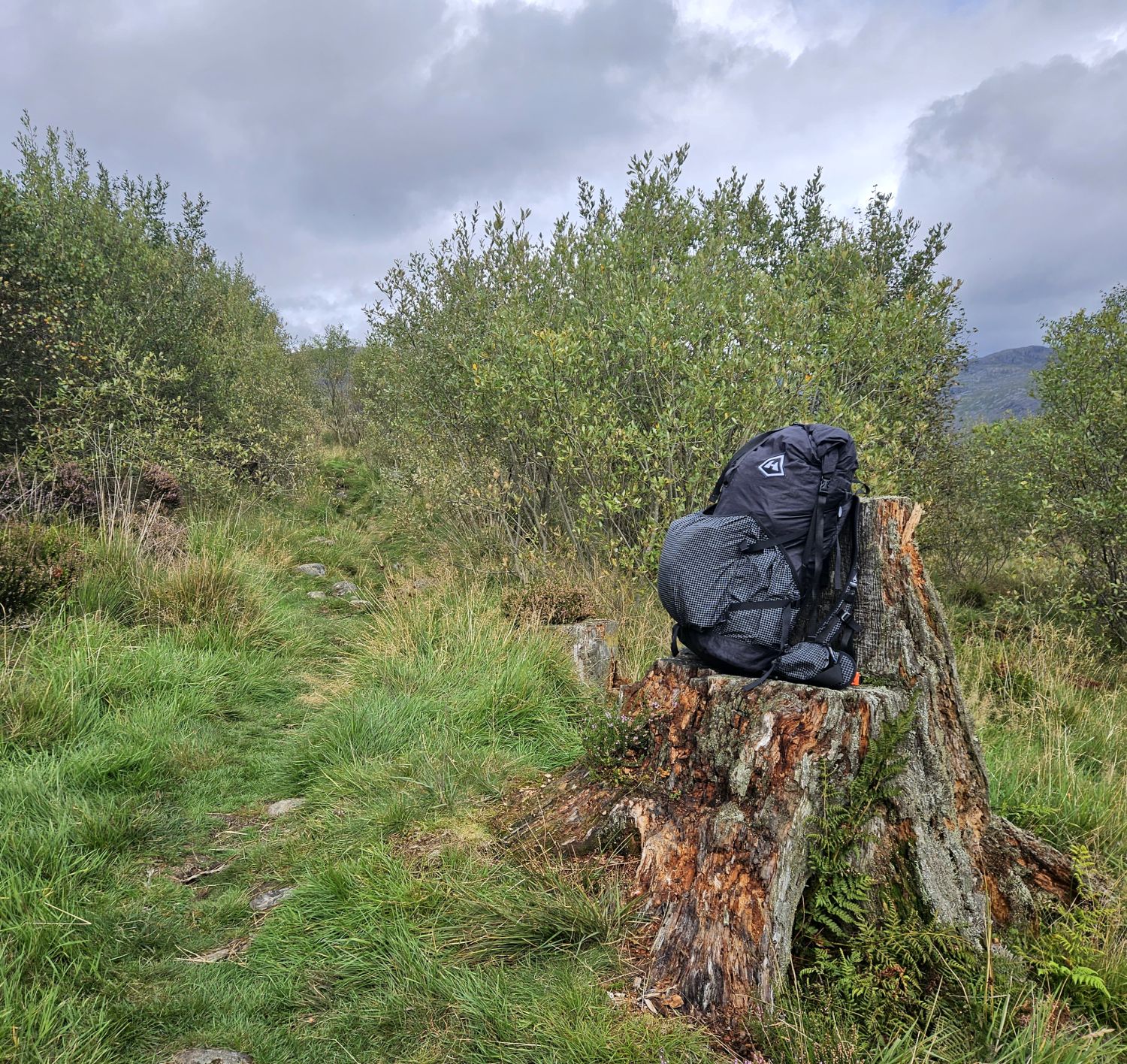
It’s time for a rest after that climb through the dense forest. The area has become more open now, and this tree stump provides a good seat for my rucksack.
13:50
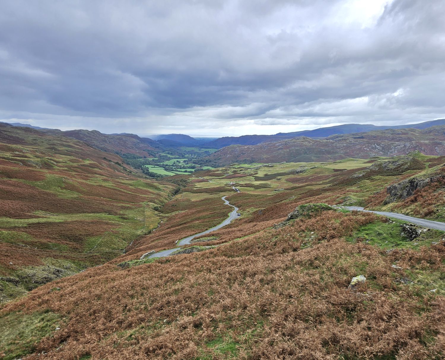
Reaching Hardknott Pass came quicker than I thought, and I’m now looking down the next valley of Eskdale. My whole route to the village of Boot is clear in front of me, which includes Hardknott Roman Fort not too far away.
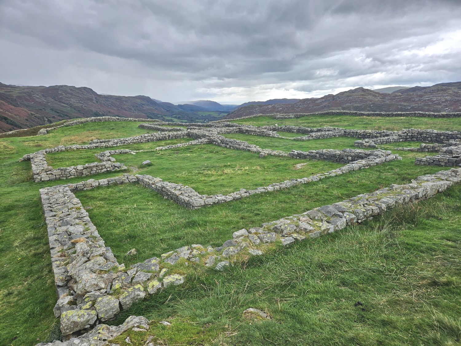
Hardknott Roman Fort is a good place to rest and have lunch and also, if time allows, explore the ruins — there are information boards dotted about that provide a fascinating insight into the layout of the fort.
14:40
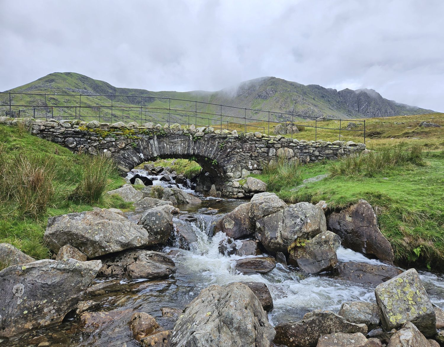
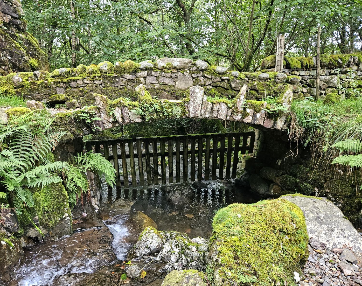
I’ve now reached the valley bottom and am stood admiring Jubilee Bridge. A lovely little bridge, isn’t it? It also seems to defy gravity, but that’s because it is made from a steel arch and clad in stone to blend in with the surroundings. It was built to commemorate the Queen’s Silver Jubilee in 1977 by Malcom Guyatt of Waberthwaite. This is one of many wonderful gems on Day 11 of the Lakeland Way.
From reaching the valley floor, it’s only around 3 miles of relatively easy walking to the hamlet of Boot. Please note that at the height of summer the bracken here can be shoulder-high.
15:40
Having crossed Doctor Bridge, I’m now following the River Esk on its northern bank. The most extraordinary thing is, it’s just dawned on me, as I pass a person walking their dog, that I’ve not seen a single person since leaving Turner Hall Farm in Seathwaite — and that was the farmer. I saw a couple of cars heading up to Hardknott Pass, but that was it. This section of the Lakeland Way is certainly the quietest of them all.
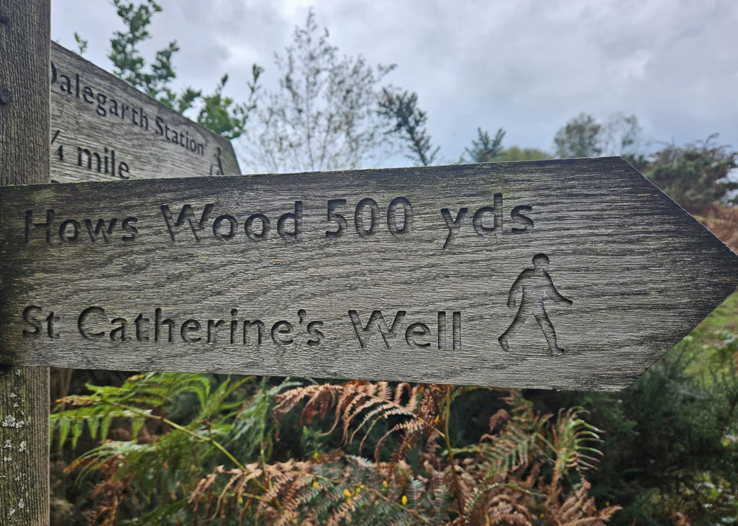
I’m now on my last mile to Boot, but I have this small hill (How) to climb to complete today’s walk. It’s nothing of a climb really — not usually — but when your legs are tired at the end of the day, and the last few miles have been level walking, this now feels like a mountain. I will visit St Catherine’s Well, which is hidden amongst the bracken, before heading for Hows Wood.
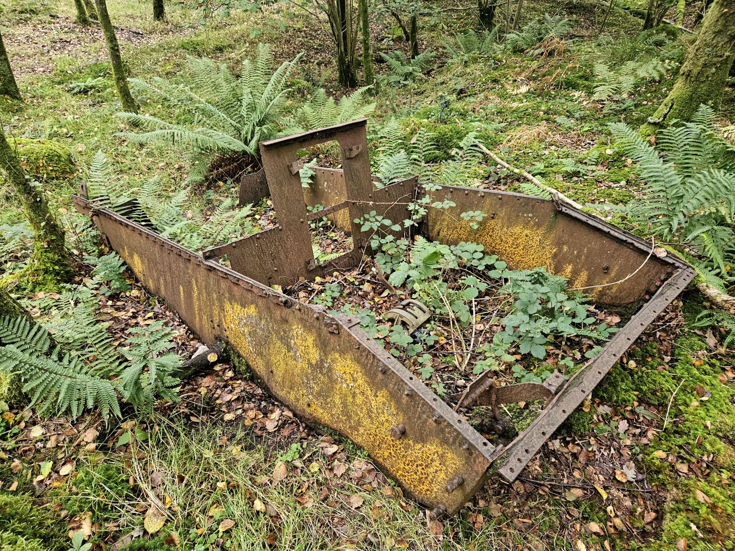
There’s much to explore in Hows Wood, including this interesting relic.
16:50
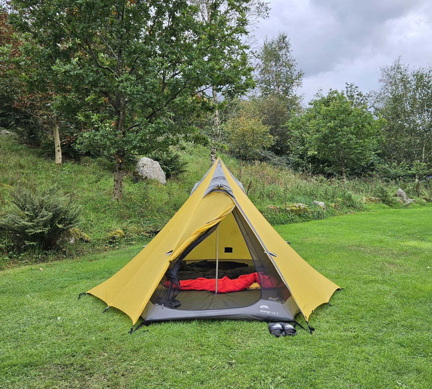
I arrived at the campsite at 4:30pm, and after a quick check-in I soon had my tent pitched and all my gear sorted. Now it’s time for a much-needed hot shower and to simply relax in these surroundings.
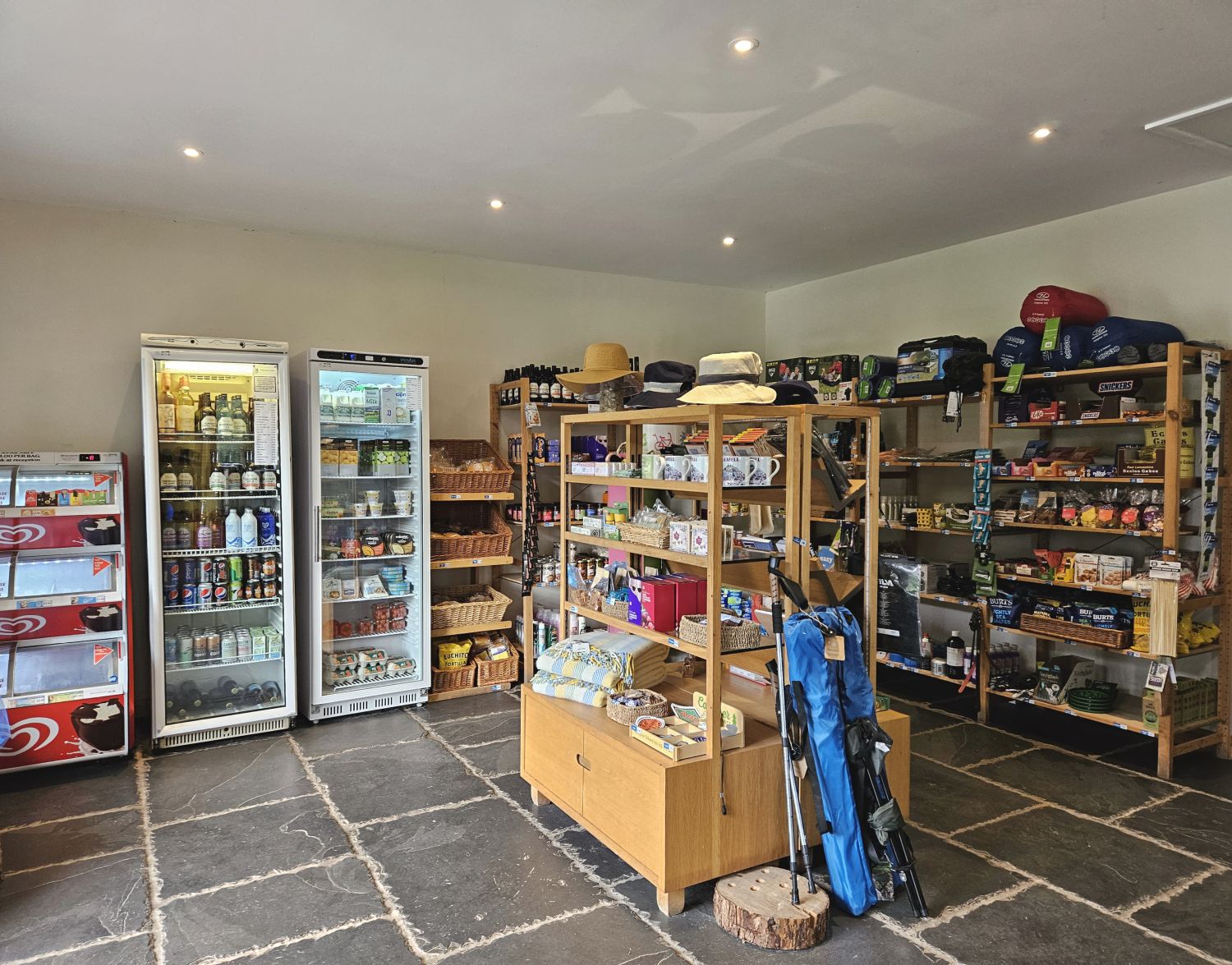
The campsite shop is well stocked with essentials, plus many rewarding treats — I think I deserve some, don’t you?
I feel much better now, especially after that hot shower followed by a chocolate Magnum. Look at my location for the night — it’s suddenly just hit me that this is my final night, and that I only have one more day’s walking to go. I can start thinking about the final leg to Ravenglass, and the crossing of the tidal ford at Eskmeals, where I’ll meet my family.
18:25
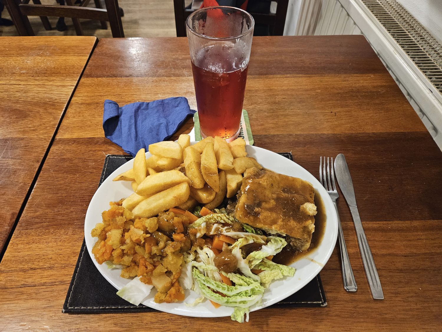
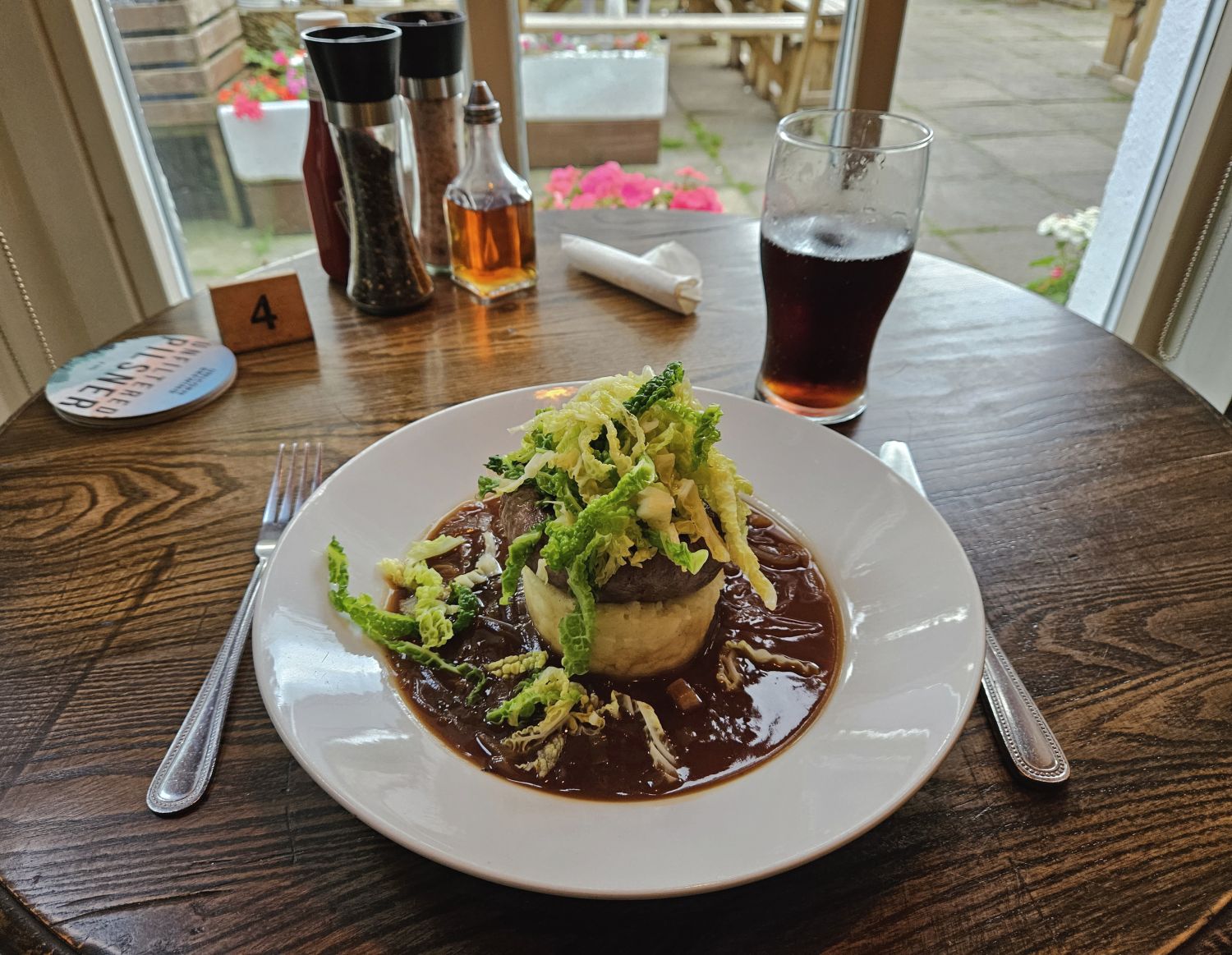
I thought I would take the short walk to the Boot Inn and treat myself to a meal. What you’re looking at is a very posh version of bangers and mash, with a sprinkling of cabbage. Thankfully I got well stocked up with snacks from the campsite shop before it shut!
What a nice, easy section that was today. It was very peaceful, and almost to the point of missing human activity. I am really missing my family now, but I have just one more night and a day’s walk to finish my journey.
A very good night from me.
Wednesday 13th September, 2023
Day 12
Eskdale National Trust Campsite to Ravenglass – 13 miles
08:50
Morning campers!
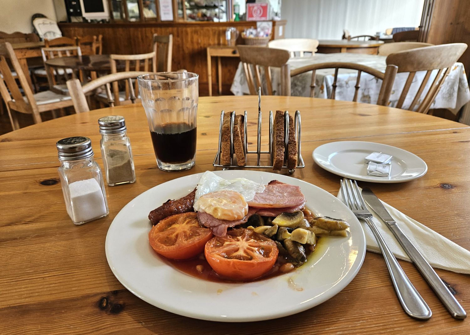
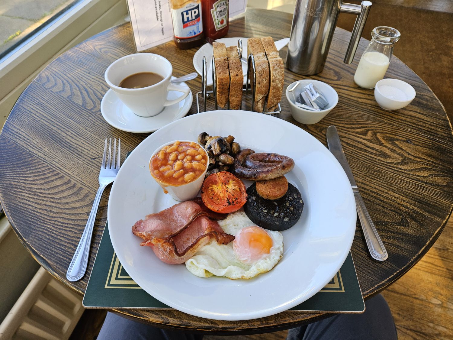
Here I am, sat in the Boot Inn, ready to tuck into this lovely, hearty breakfast. I’m now on familiar ground, having booked this while passing through on Day 1 of my very long walk in the Lake District. It’s also suddenly dawned on me that this is my last hot meal on the Lakeland Way, on the last day of twelve, and I’ll soon be seeing my family near the end at Ravenglass. Talk about mixed feelings! I suppose most people feel like this towards the end of a long-distance hike, knowing that your journey of adventure is about to end.
09:50
The weather has been fantastic, and today is certainly no different. To take advantage of that — and with low tide at the estuary not until 5:30 this afternoon — I’m taking my time this morning to dry out the tent as much as possible. The stay at this National Trust campsite has been tremendous; by far the best of my trip, in a wonderful setting. The shop and staff have been great as well.
10:30
I’m now on my way, leaving the small hamlet of Boot. It’s only around 13 miles to the coastal village of Ravenglass, with some long stretches of fairly easy walking, so there’s no rush at all — I really want to take in what this last section has to offer.
The first half mile of today’s walk is the only part of the Lakeland Way that is walked twice.
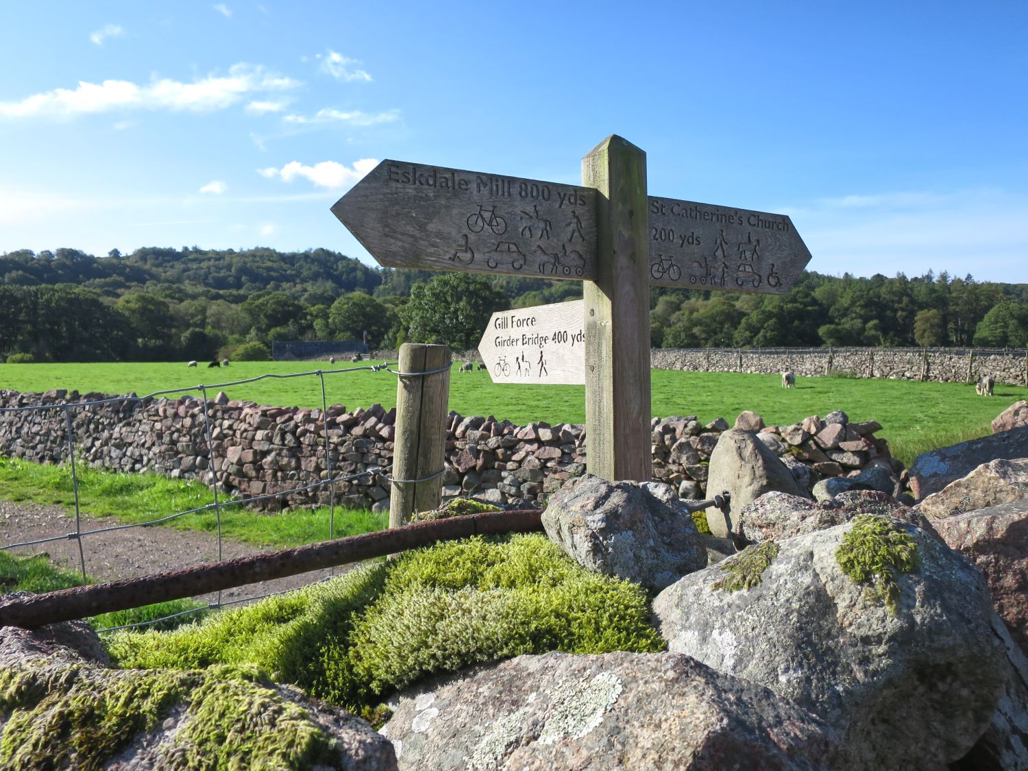
Rather than visiting St Catherine’s Church as on Day 1, the route now follows the old railway line to Girder Bridge over the River Esk.
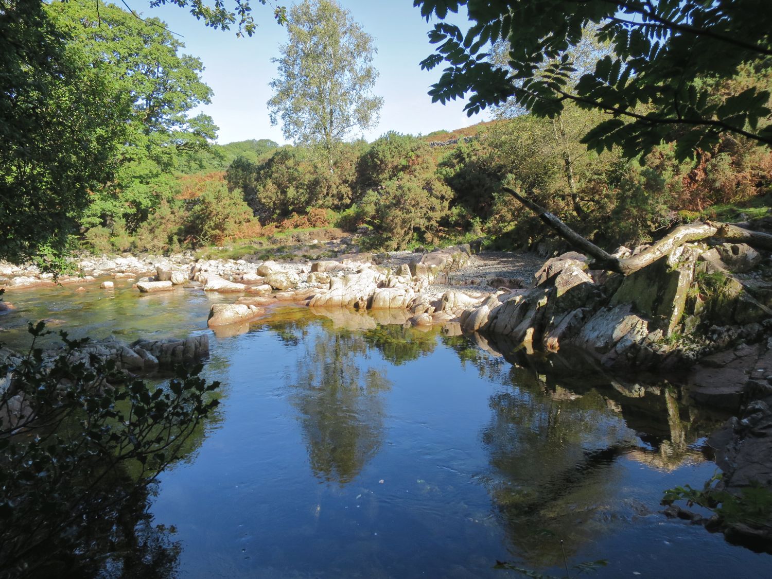
It’s so wonderful to see the River Esk again — and, without complaining too much, it’s also nice to be in some shade. It’s very warm again, which has been the story throughout this trip.
11:00
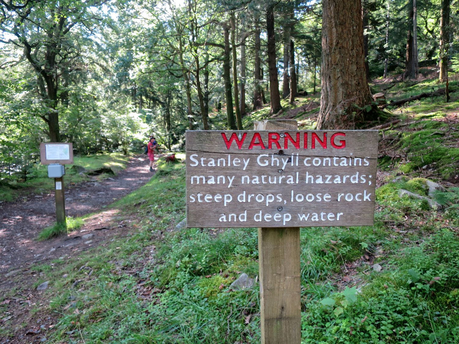
I’ve now reached the base of Stanley Ghyll, a deep ravine of footbridges, waterfalls, and fallen rocks. There are many people about now, which is a change from the isolation of yesterday’s walk from Seathwaite in the Duddon Valley. I’m enjoying saying hello to so many walkers, though I do stand out a little among the trainer-clad dog walkers — it’s not likely that many multi-day hikers head up this ravine and beyond.
11:15
I reached the top of the ravine and to the viewing platform in a record time of 15 minutes — does that mean I’m totally fit now?
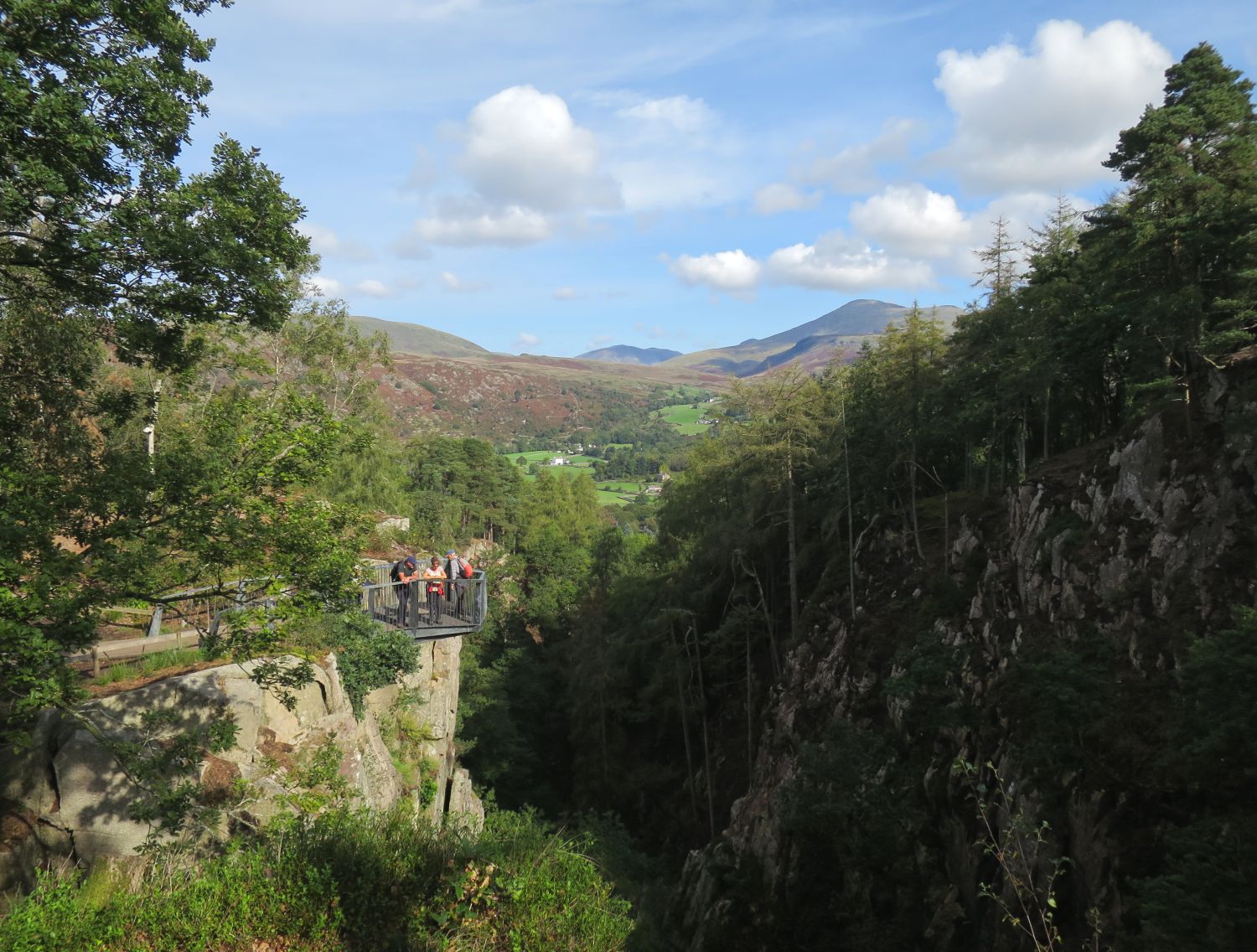
I really do adore this view, looking back over the platform and beyond to Boot and Eskdale Moor. This takes in a large section of Day 1, with Kirk Fell at the back and Scafell over to the right.
The views behind are fantastic, which will be a recurring theme for the next few miles. This is the point where you begin to say goodbye to mountainous Lakeland.
11:55
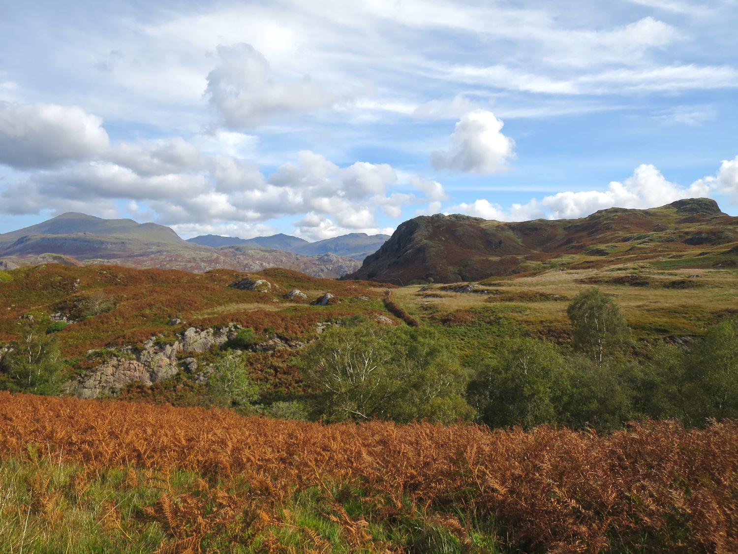
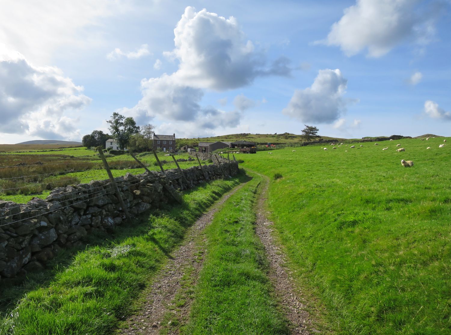
It’s approaching midday and I’m nearing High Ground Farm, having just enjoyed a nice, easy walk from the top of Stanley Ghyll. I’m alone again, aside from pastures and grazing sheep. This is a lovely section, though it’s becoming apparent that the landscape is changing.
Having passed through farmland, I’m now returning to fells, moorland, and tarns. This is the long, straight track to Devoke Water.
12:40
I’ve just reached the head of Devoke Water and it’s so peaceful — not a soul about, just myself and what remains of a bag of nuts and a cereal bar for lunch.
I’m now sat looking back towards Seat How and the boathouse, having just collected my last mountain water from a small beck running down from Stord’s Hill. It tastes wonderful, and the view isn’t bad either. From here it’s bog and farmland, so there’s very little chance of finding decent drinking water — not until Waberthwaite, where there’s a shop.
13:15
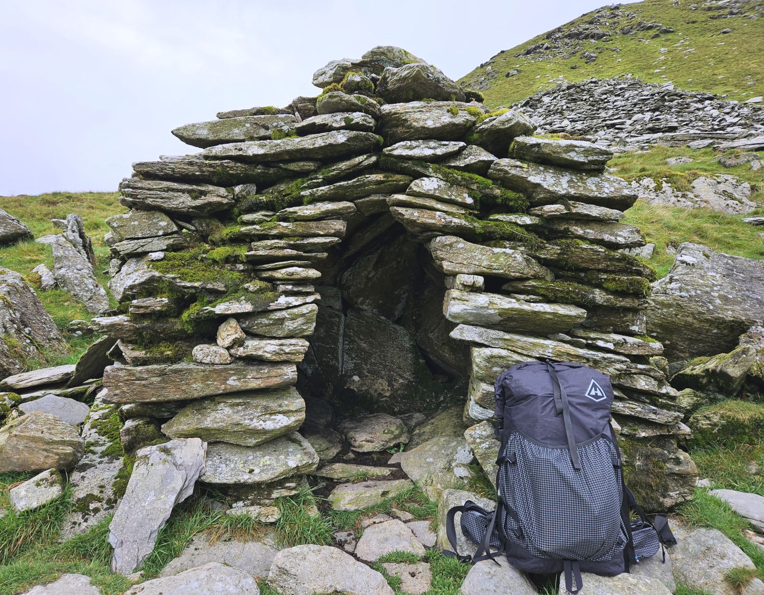
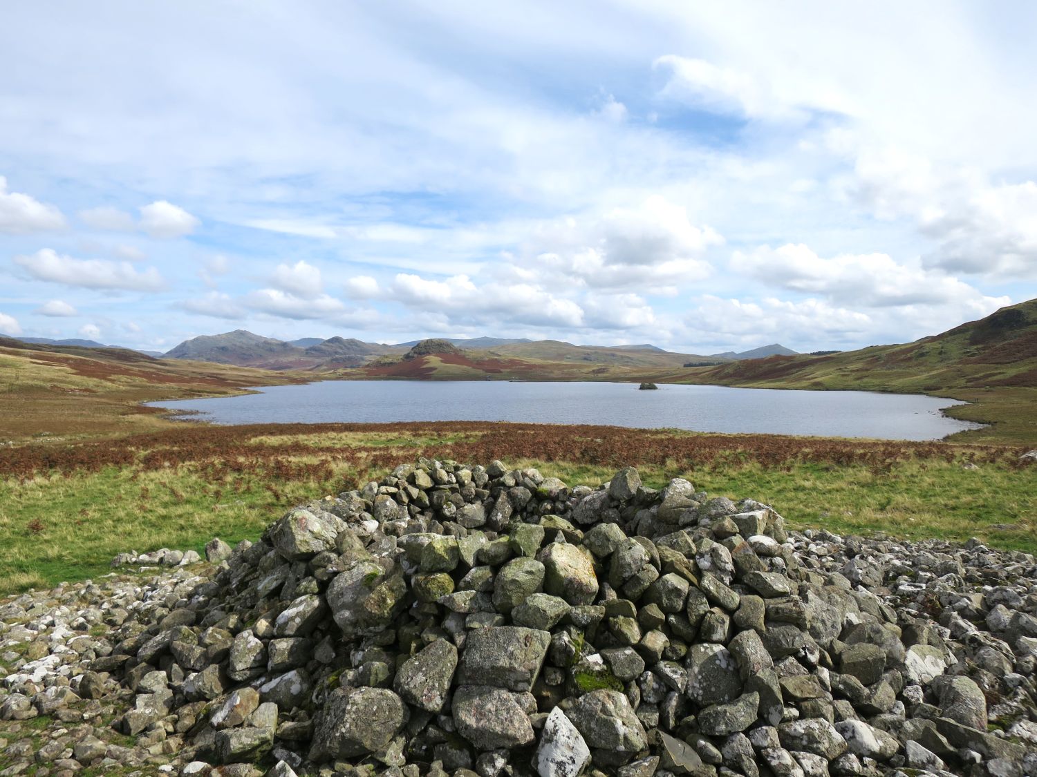
I’ve now arrived at the large cairn just beyond the foot of Devoke Water, which offers a fine view of the fells to the east and the land leading to the sea in the west. The cairn was originally a burial mound of stone, though it now serves as a shelter.
It’s time to get my boots wet! After a short rest at the cairn, I’ve joined the Romano-British trackway that leads to Barnscar and Birkby Moor — it’s going to get squelchy from here.
The sea — I can see the sea!
For at least a mile or so, the trackway is ingeniously marked by ancient upright stones, forming avenues all the way to the settlement on Barnscar. I wonder if these ‘gates’ date back as far as the settlement — it’s a nice thought, and would make sense.
I paused for a moment to look back one last time at mountainous Lakeland before continuing on the final leg to the sea.
14:00
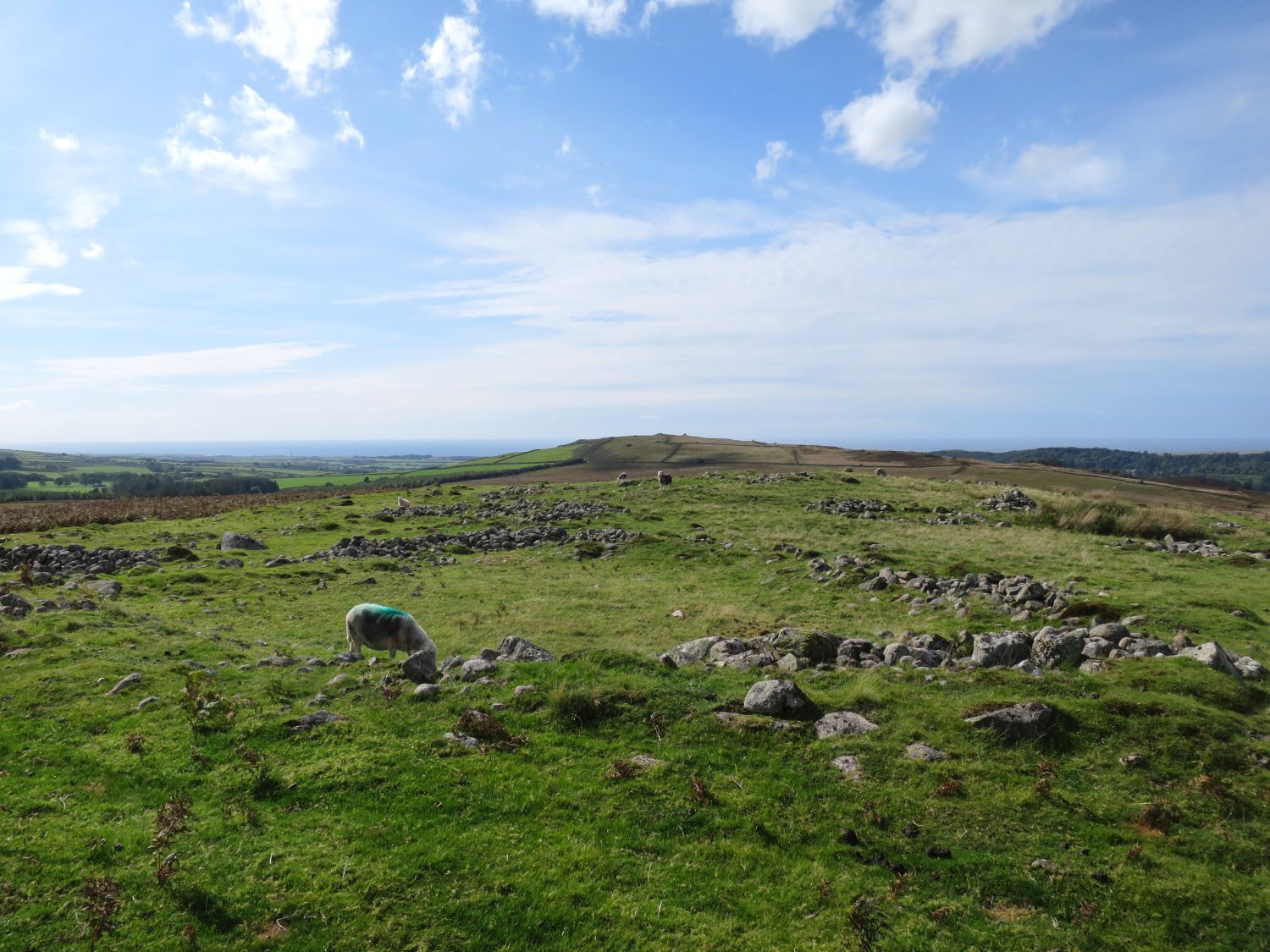
I’ve arrived at the Romano-British farmstead on Barnscar, and ahead lies my final ascent of the trip — a small, unnamed hill forming a continuation of the ridge towards the Irish Sea. It’s home to Stainton Tower and offers a wonderful view of the sea and the estuary crossing to come.
For now though, there’s much to explore around the farmstead, including trenches, cairns, and hut circles.
The section I always dread. I don’t know why I fear the Bog Monster of Birkby Moor — I’ve never seen it and I’ve always managed to cross unscathed, but I still get a little nervy.
The key to crossing this bog is to use the tussocks on the left and avoid the moss on the right.
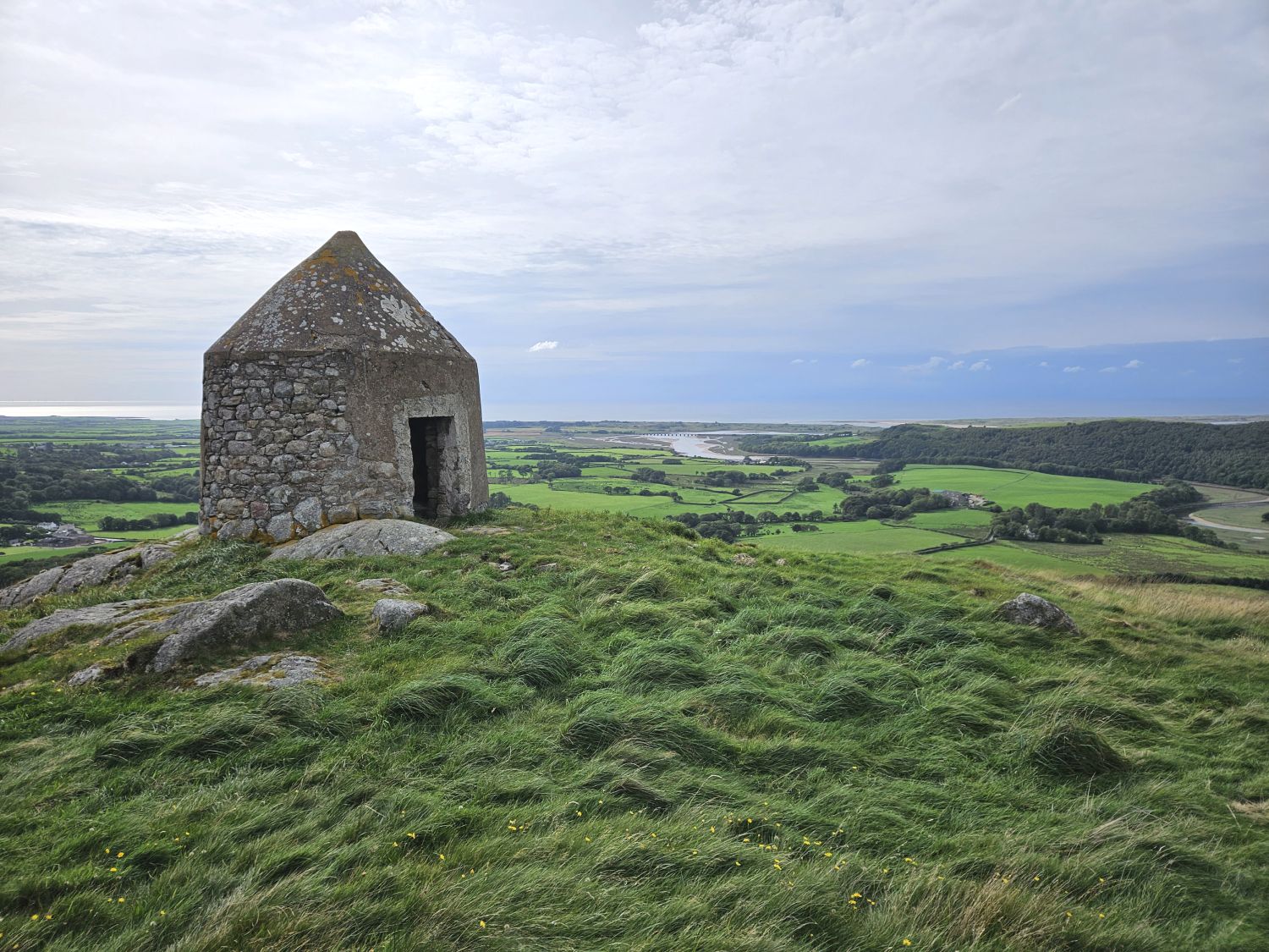
14:50
I survived the bog and have just arrived at the Pepper Pot (Stainton Tower) in good time. Low tide is still two and a half hours away, so there’s no rush on this final stretch to the sea.
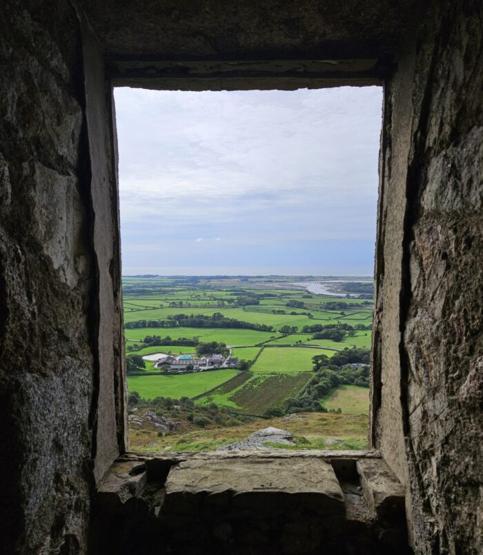
I love the view from the tower window. You can see the River Esk on its final journey to Eskmeals Viaduct, before continuing on to Ravenglass where it meets the sea.
From here, some may choose a more direct route to Muncaster Bridge and through the gardens, but I’d recommend sticking with the Lakeland Way. The descent that way can be tricky, and the road walking along the A595 isn’t particularly pleasant. The estuary crossing, by contrast, feels like a far more fitting and memorable finish.
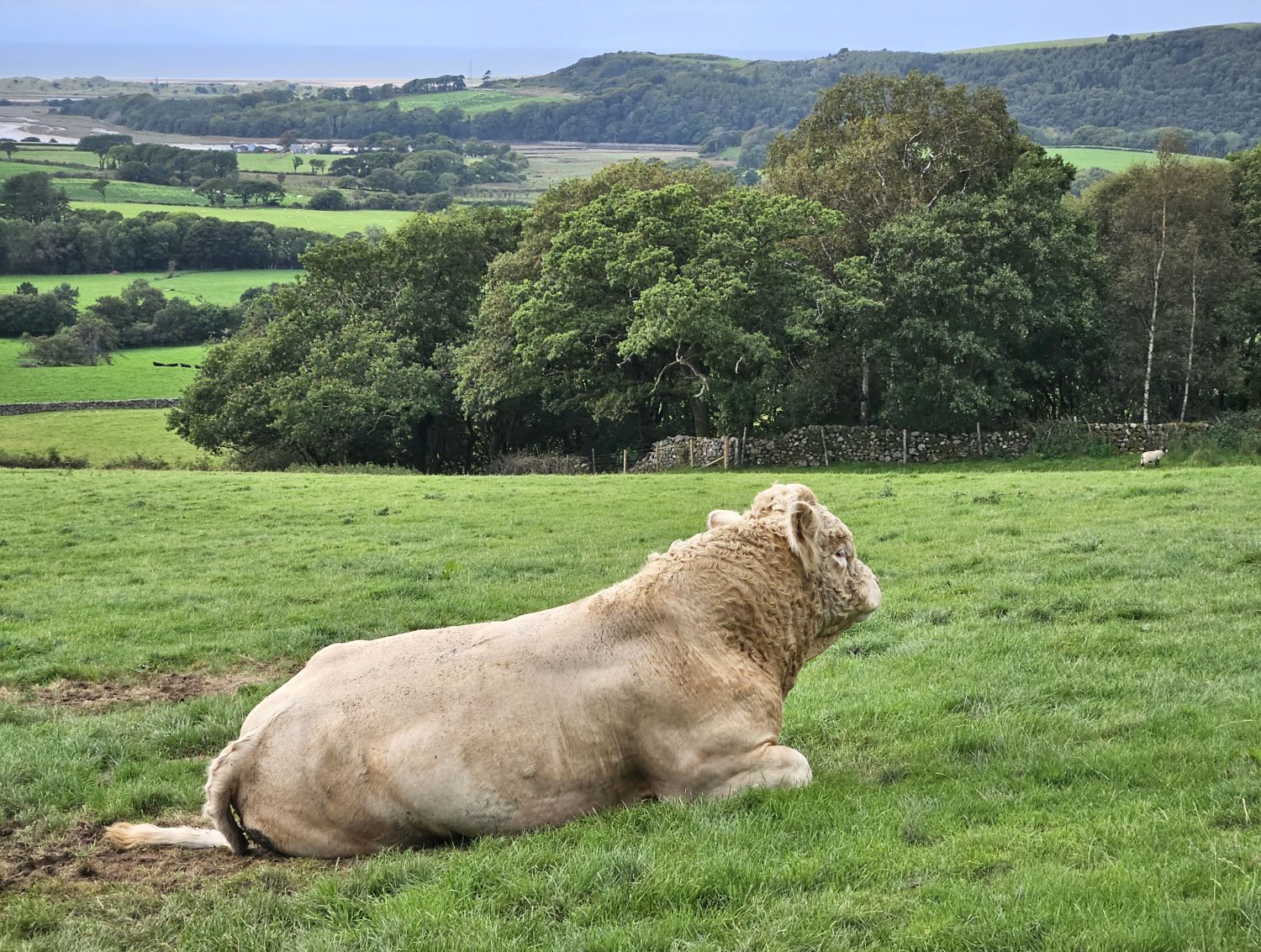
The terrain has now completely changed, and you may encounter cattle on the track towards Broad Oak, though these can usually be avoided.
The short section between Broad Oak and Waberthwaite is perhaps the least appealing part of the route, with a few neglected stiles and footbridges. It can feel a little like passing through someone’s back garden, and locals may be surprised to see you. Until the route becomes more established, this may remain the case.
With that in mind, pass through quietly and stick to the path — and, as a reward, there are treats at the village shop in Waberthwaite.
16:50
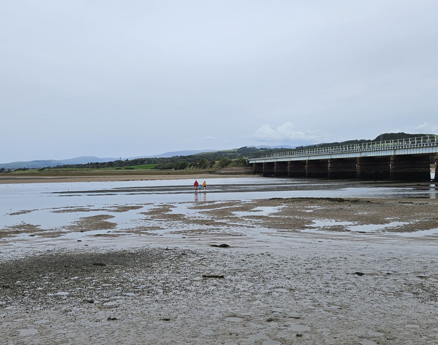
I’m sat on the south bank of the estuary at Eskmeals Viaduct, and making their way across the tidal ford towards me are my family and a good friend, John Falcus — John was the first person to complete the Lakeland Way and has kindly travelled from the North East to walk the final mile with us.
I arrived here about an hour before low tide, and even then the crossing looked possible. If my eight-year-old daughter can do it, then anyone can. What I will say is that it’s a wonderful way to thank your feet for carrying you across 144 miles of Lakeland.
Now it’s time for hugs.
17:45
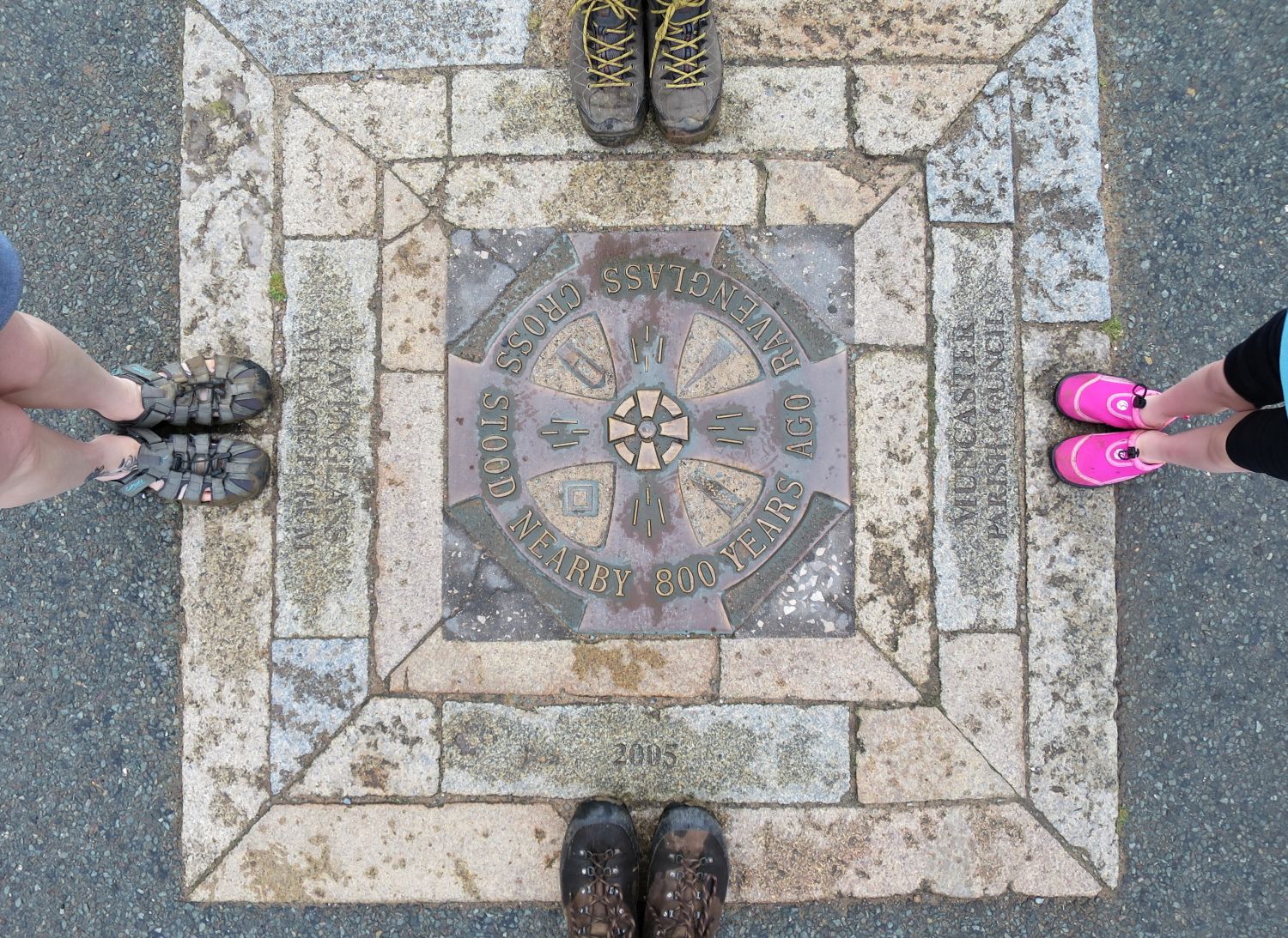
Finished! I’ve completed the Lakeland Way in one go. After all the recces and research over many years, it feels special to arrive at the Ravenglass Market Cross knowing that every section works, and that the route comes together as something quite special. I genuinely believe that anyone who takes it on will find it a rewarding and memorable journey.
19:15
My family is the best!
Conclusion
Now that I’ve completed the Lakeland Way in one go, I have a much clearer sense of how the route works as a whole. I had walked many of the sections — or parts of them — numerous times, but until you link them together into one long journey, it’s hard to know how well it will work for others in the future. I have to say, it’s come together really well, and the highlight for me personally was the rewarding feeling of walking from one valley to the next, just as early traders did for centuries.
The biggest surprise — and a real blessing — was the sense of isolation on certain sections. While I expected places like the Duddon Valley and Birker Moor to be quiet, I was genuinely surprised by just how peaceful areas such as Troutbeck and Eskdale felt at times.
What would I change? I did make a few errors. Firstly, taking a nylon tent instead of polyester proved to be a mistake due to moisture absorption, and it wasn’t the most suitable shelter to carry on a long-distance hike over high terrain. The second was my timing — I arrived at Wasdale Head on a weekend, when it was extremely busy, and found myself in a bit of a rush to get pitched and sorted for food.
What wouldn’t I change? If you’re planning to camp the route over 12 days, I feel the logistics worked well. The distances between campsites were well balanced, and the places I chose to stop and eat fitted nicely into that itinerary. Drinking on the go was also hugely beneficial, so I’d highly recommend taking a reliable water filter.
I completed the route over 12 days, including eight official campsites and three wild camps, and if it hadn’t been for the heat, it would have been a fairly straightforward and very enjoyable hike. Next time, I’d like to push things a little further and aim to complete it over nine days, with fewer campsites and more wild camping, along with a lighter setup — most likely including a Durston X-Mid 2 (polyester).
It’s been a journey that’s tested me, surprised me, and ultimately confirmed why I wanted to create this route in the first place.
Here’s hoping for cooler weather on the next adventure.
Richard