
Ron Scholes was a schoolmaster, later a headmaster, a BBC Radio Stoke broadcaster, and an established author of walking and countryside books. Over many years, he produced a substantial body of work covering northern England and beyond, including Walking in Eden, and guides to the Yorkshire Dales and surrounding regions, a range of visitor and landscape titles, and culminating in his final and most personal work, A Pennine Odyssey. His writing combined practical route knowledge with history and landscape, along with his detailed connection with Alfred Wainwright.
He was also a committed long-distance walker, devising routes of his own, most notably the Ravenber Way from Ravenglass to Berwick-upon-Tweed. That walk was inspired by Alfred Wainwright’s own Coast to Coast Walk and reflected what Wainwright had hoped his 1973 guide would encourage others to do: to create their own journeys across country. Wainwright was pleased that his work had influenced Ron’s long-distance walk and had helped him devise it.
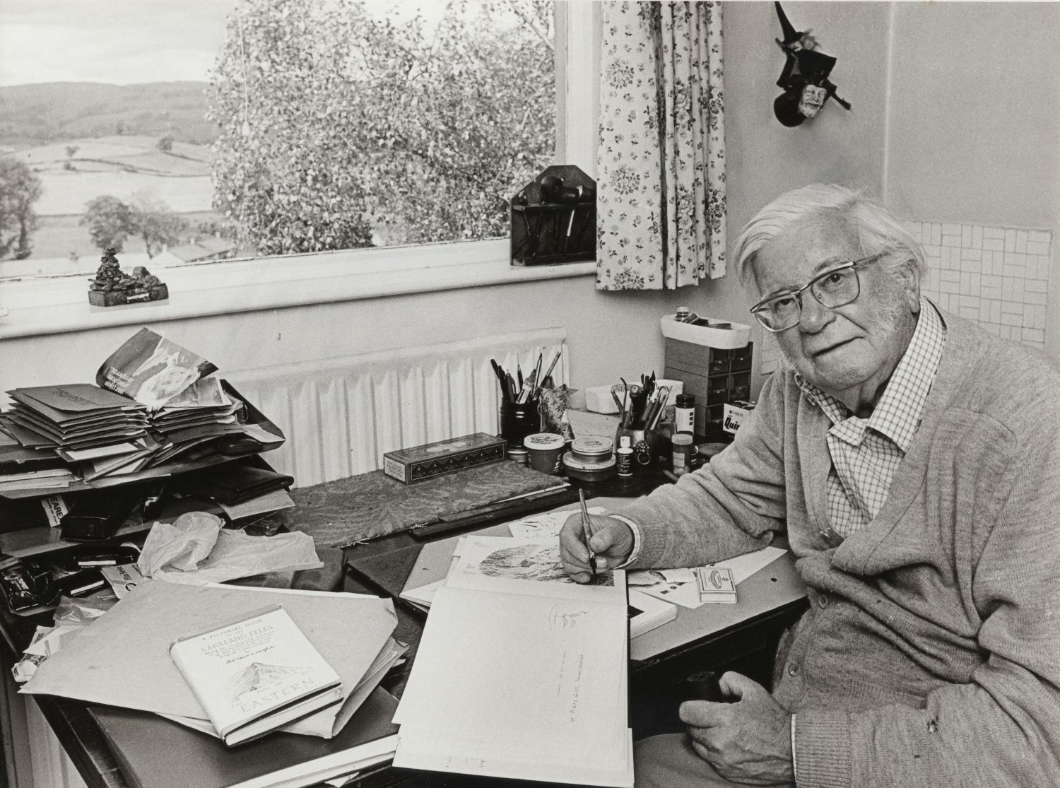
Ron’s connection with Wainwright began in 1979 through correspondence, after Ron donated the proceeds of one of his illustrated talks to Animal Rescue Cumbria. From that point, a lasting friendship developed. Ron visited Wainwright and his wife, Betty, at their home at Kendal Green on several occasions, sometimes staying overnight, and they kept in regular contact through letters and meetings.
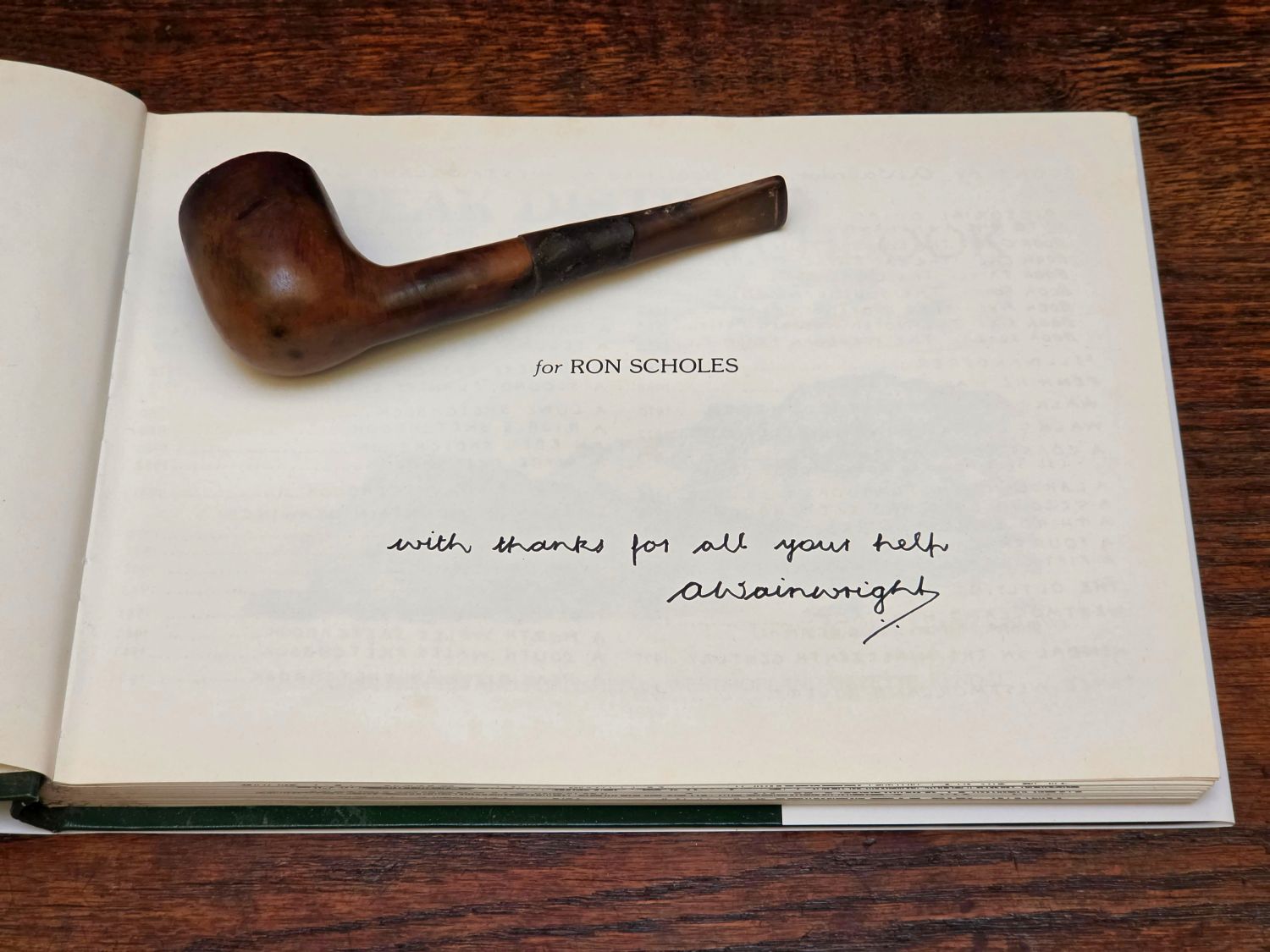
Their discussions covered long-distance routes including the Pennine Way, the Coast to Coast and the Cambrian Way, as well as the practical side of writing and publishing guidebooks. Wainwright took a direct interest in Ron’s work, offering advice and encouragement over several years. That regard was further reflected in the dedication of A Peak District Sketchbook in 1984, Wainwright’s final sketchbook, to Ron. Wainwright had intended to work on further projects with Ron, but by this stage, his eyesight was failing, and he was no longer able to continue.
It was through this friendship that Ron arranged to record a conversation with Wainwright about the road over Wrynose and Hardknott. The recording was made in 1987 using a 5-inch reel-to-reel tape recorder borrowed from BBC Radio Stoke. Ron later wrote that after the interview, he moved house and the tapes were mislaid, remaining lost for many years. They were only found after Wainwright’s death, when a friend of Ron’s, David Burrowes, edited the tapes and copied them onto disc, preserving the conversation.
I first contacted Ron by email in 2017, and we corresponded regularly by email and over the phone for many years. Ron kindly gave me a copy of the original recording between him and Alfred Wainwright, which has been transcribed word-for-word.
<<>>
High Roads of Britain
1. Introduction by Ron Scholes
Roads are an almost totally neglected aspect of local and indeed national history, and yet the road network has always been a vital part of the development of the country. The earliest identifiable roads were made by the Romans. Though the full extent of their road system is still not known, their roads were used for the successive invasions of Anglo-Saxons, Norsemen and Normans. Many Roman roads are still in use today.
Meanwhile, during the Dark Ages, local tracks had come into use as trade routes between the hamlets and settlements. The Normans introduced monasteries, and towns began to grow soon after. The roads, which developed during this period, virtually completed the road network as we now know it. Certain roads were used by packhorses or as cattle drove roads. Mountain passes came into use, and together with routes over high and difficult country, these were used in order to escape the payment of tolls on the turnpike roads, which were constructed in response to the agricultural changes in a particular area. Other areas which had been common or wasteland were enclosed and had new roads laid out across them.
Today, many of Britain’s high roads briefly receive a mention when the main routes become snowbound, and names like Cock Bridge to Tomintoul, Hartside, Snake Pass, Cat and Fiddle, Milltir Cerrig, and many others. Well, they induce people interested in the geography and history of the countryside, I am sure, to flick through their road atlases. They may indeed decide to visit a particular area crossed by a high road during their next holidays.
You can be sure that whether it is by main route or minor road, the crossing of a mountain pass or a stretch of high moorland is a complete experience in this beautiful country of ours, which overall has a variety of landscape scenery second to none in the world.
To help us on our way, there’s always, round the corner so to speak, a fascinating snippet of knowledge, some fresh aspect of information, and invariably a local character to increase the pleasure of travelling on the high roads of Britain.
2. Alfred Wainwright
Ron:
In the north of England, the English Lake District is an area visited by millions of people, keen on fellwalking, climbing, sailing and motoring, or simply happy to look around at the many scenic delights that the area has to offer.
Today, I’m very pleased to talk to Alfred Wainwright at his home in Kendal. This well-known walker, author and artist is renowned for his Pictorial Guides to the Lake District Fells. AW is an authority on the mountains and fells of the Lake District, so I’d like to ask him his impressions of an exciting road that passes through the heart of the Lake District mountains.
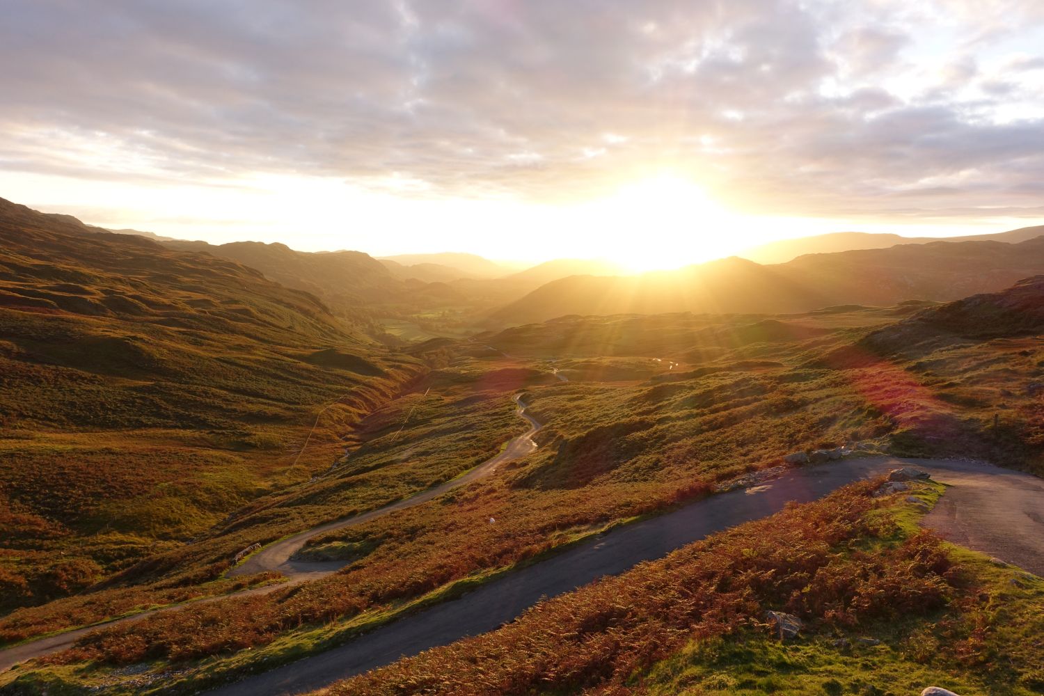
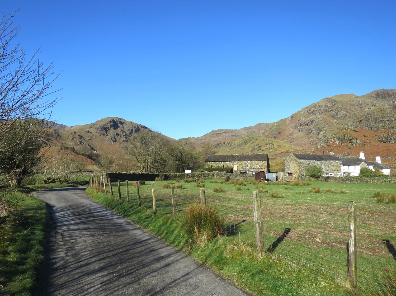
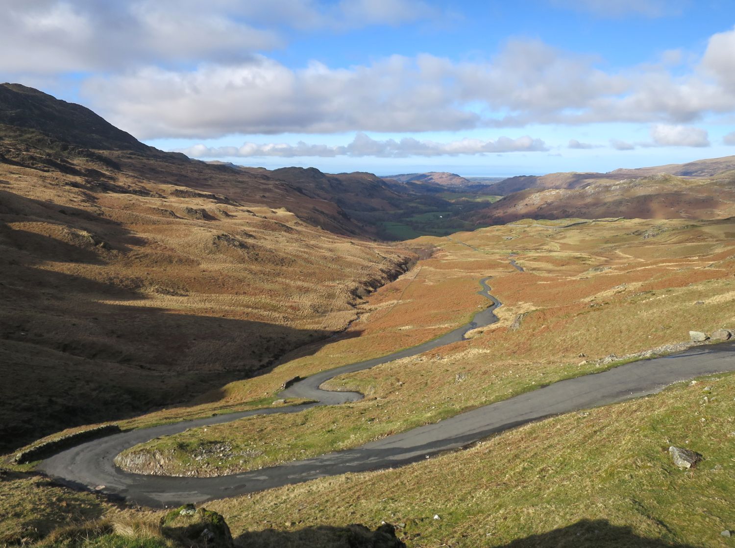
To set the scene, the motorist will leave Ambleside on the A593 to Skelwith Bridge, where the main road climbs beneath the slopes of Park Fell, to a point where a minor road turns right, which twists and turns down to cross the River Brathay and into Little Langdale. We are now ready for our journey over the Wrynose and Hardknott passes.
Well, today, I’m very pleased to be able to talk to Alfred Wainwright at his home. This renowned Lake District walker, who knows the area far better than most people from the walking side of things, is going to tell me a little about this road, because it is the road that crosses the passes, the passes, the Wrynose Pass and the Hardknott Pass. So first of all, to AW, and see what he has to say.
AW:
Many of the mountain passes in Lakeland are crossed by motor roads, and all are scenically attractive. But I think the one you’ve chosen to discuss today is probably, and certainly is in my opinion, the finest of them all. It’s a route that goes back to Roman days. The Romans had to link the forts at Ravenglass and Ambleside and devised a route which couldn’t avoid the high ground altogether, but made use of two natural passes: Wrynose Pass and Hardknott Pass.
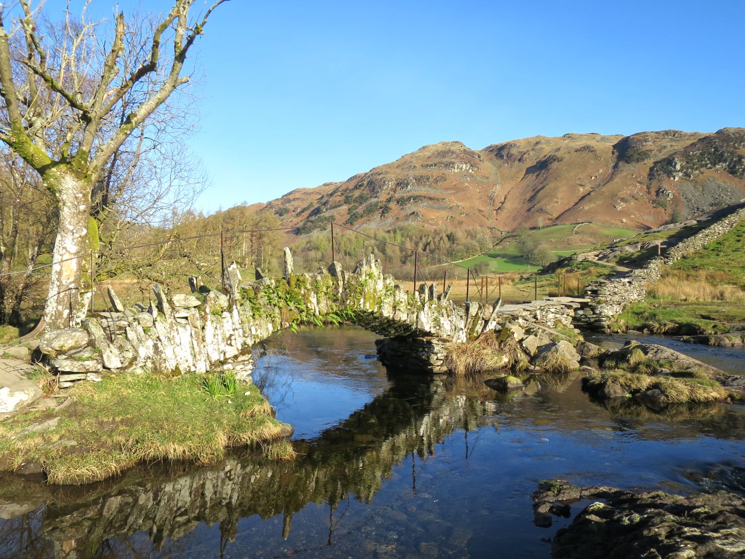
Starting from Ambleside, you pass through Langdale, cross over into Little Langdale, and there, and in many places along the route, you’ll find little diversions of extreme interest. In Little Langdale, I would mention Slaters’ Bridge, a short distance across the fields from the road, a bridge made of slate and attributed to the men who worked the slate quarries just across, just over the bridge. There are several very, very large slate quarries there, and as a shortcut, this bridge was constructed by the men. So, it probably goes back three or four hundred years.
Ron:
I presume, AW, that if you took that route, you could do a fell walk, could you not?
AW:
Yes, you could. You’re passing in Little Langdale between Loughrigg Fell, on one side, and the outliers of the Coniston Fells on the other. Yes, you’re free to wander about there. But at this point, Little Langdale Road is enclosed by stone walls, so it isn’t easy to get away from it. Later on, as we get out of this valley and start to climb up to Wrynose, you can wander anywhere.
3. The Wrynose Pass
Ron:
Now we’re going to go on our journey up the Wrynose Pass, AW.
AW:
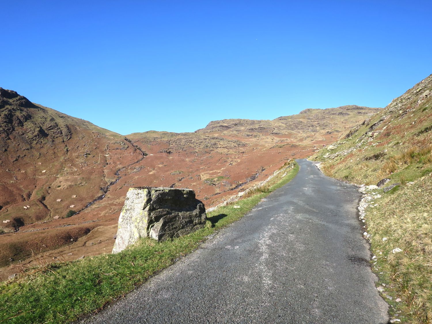
Right. The last farmhouse that you pass is Fell Foot, and then the adventure starts. You’re away from the valley, you’re away from cultivated pastures, you’re in the wild, and there’s a steady incline up to the head of the pass. On the left, as you’re going up, you’ll find a boulder with a flat top, and that’s called the Pedder Stone.
Ron:
And what does that mean, AW?
AW:
Well, according to the story, it’s a place where the packmen and the packwomen, who used to carry their trade on their backs, used to rest their loads there as they were passing from one valley to the next.
Ron:
And I believe this is actually marked on the present-day maps?
AW:
I think it is. Yes, I think it is. Yes, they could ease their load on their shoulders by resting their pack on the flat top of the boulder at the roadside.
Ron:
That’s fascinating.
AW:
A little further up, you’ll find obvious traces of the Roman road. It’s running parallel with the new road.
Ron:
So there are some sections that can be traced?
AW:
A few, and there is one, a good one. But this part of Wrynose Pass was very badly cut up during the war, because the army used it with the military machines.
Ron:
What a shame.
AW:
But it has been restored. It’s a good surface, but it’s a narrow road.
Ron:
And can motorists stop to admire the scenery?
AW:
In a very few places, you can pull off the road. It’s wide enough to pull off the road, but there are no recognised passing places.
Ron:
And then you’ve got, I presume, a steep little final bit to get to the top of the pass?
AW:
Yes, and that’s where you see the Roman road on your right as you’re going up.

Ron:
Now, according to all the maps, there is a Three Shire Stone at the head of the pass?
AW:
That’s true. It’s a bit obsolete now, because it used to represent a meeting point of Lancashire, Cumberland and Westmorland, but everything there now is Cumbria.
Ron:
I suppose if you’re coming out of the mist, having come off the Fells, and you see this stone pillar, at least you’ll know where you are, AW?
AW:
You’ll know that you’re at the top of Wrynose Pass.
AW:
Right, we’ve got to the top of the pass, now can you recommend a couple of good mountain walks from here?
AW:
Oh yes, splendid walks. On the left, you can climb up to Wet Side Edge, and there’s now a path up there, and follow the ridge upwards over Great Carrs to Swirl How.
Ron:
And that’s part of the Coniston Range?
AW:
Swirl How is, in fact, the highest of the Coniston Fells. So that’s a splendid walk, and an easy one. Even easier is the walk on the right-hand side, which goes up to Red Tarn, quite a broad track, well-trodden track, goes up to Red Tarn, and there, you can start to climb either Crinkle Crags, on the left, or you can turn around a bit and follow a path up to Pike o’ Blisco.
Ron:
Pike o’ Blisco, what a lovely-sounding name.
AW:
It is a nice name.
Ron:
It almost attracts people to go, and to want to climb it, doesn’t it? Could the normal walker, if they were not particularly mountaineers, they could climb these hills that you’ve mentioned?
AW:
Yes, but they want to be properly shod; it’s rough, very rough walking.
Ron:
Rough walking, so properly equipped, and some spare food and spare clothing. The normal precautions for a walk on the hills?
AW:
That’s right, and take care to put your car up, off the tarmac, or you’ll have a new infuriated gang of people waiting for you when you come back.
4. The Hardknott Pass
Ron:
Right, AW, we’ve had our walk, we’ve had a good look round from the top of the Wrynose Pass, onward, down the pass. Is that right?
AW:
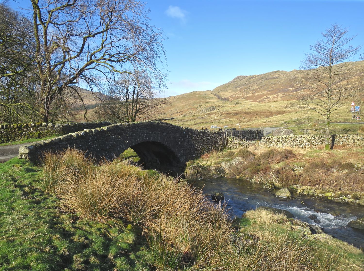
Yes, over the pass the road continues, still narrow, still unenclosed, and now has the River Duddon running alongside, as far as Cockley Beck two miles further. At Cockley Beck, the valley road continues to come down to the sea at the Duddon Estuary, but our route crosses the bridge, and after an easy start, the gradients worsen, in places one in three.
Ron:
This is a real test for the motor, isn’t it, AW?
AW:
Yes, this is no place for a learner driver, and there’s no doubt that this is the most serious motor climb in the Lake District, up to the top of Hardknott Pass. Quite an experience on my first visit, you wonder whether you’re going to get to the top, because the bends are severe.
Ron:
Yes. I’ve often wondered whether the car will make it, because you’re right, some of those bends are very steep and very narrow.
AW:
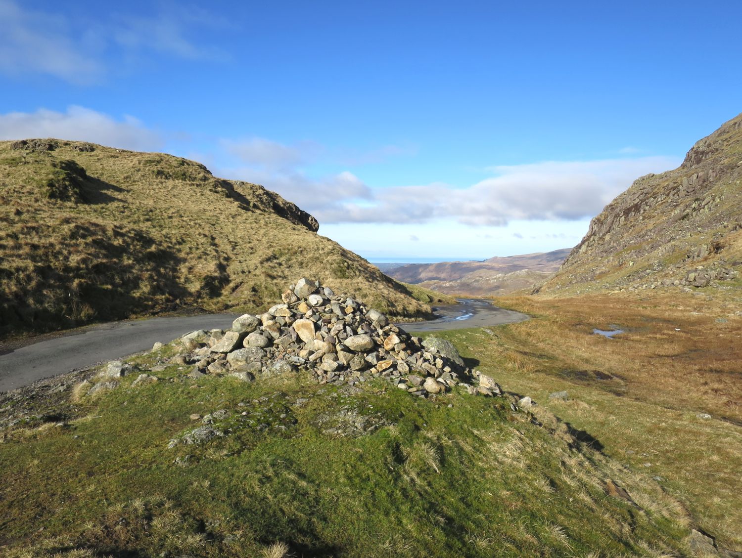
Yes, one in three. But then at the top of the pass, the road eases off, and it’s quite a pleasant place for a stop and a picnic.
Ron:
I suppose you can just pull off, although there isn’t much room there?
AW:
There isn’t much room, but there’s just one or two places where you can pull off the road.
Ron:
And what’s the view from there like, AW?
AW:
Well, the most charming thing about the view from Hardknott is the lovely valley of Eskdale, which you see winding away towards the sea. There’s rough ground on the left, but you can negotiate it and arrive at the top of Harter Fell, a beautiful mountain.
Ron:
That’s the peak, as you say, a very beautiful peak on our left-hand side?
AW:
Yeah. Although its beauty isn’t obvious till you get down in the valley, you’re on a rather indeterminate ridge as you’re going up to the top.
Ron:
So, its best aspect is viewed from lower down?
AW:
Yeah, but the summit of Harter Fell is one of my favourite spots in the Lake District.
Ron:
Is it really?
AW:
All rock. In fact, you can’t really say that you’re on the highest point until you’ve done a bit of rock climbing.
Ron:
And that’s what you find at the top of Harter Fell?
AW:
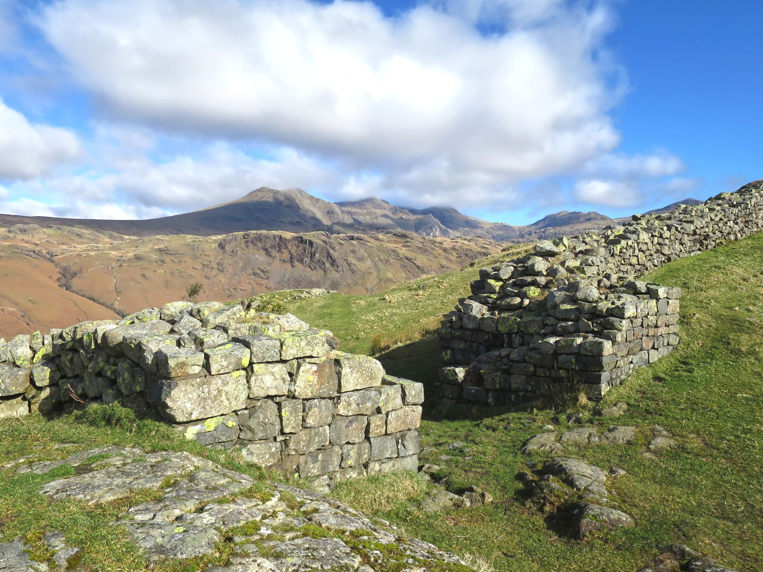
That’s Harter Fell, yeah. Now, the road now descends into Eskdale, another couple of miles across an open moor. Still unenclosed, still narrow, but before you actually reach the valley, on a little shelf on the right, is the best of the Roman camps in Lakeland, the best preserved of the local camps in Lakeland.
5. Hardknott Castle
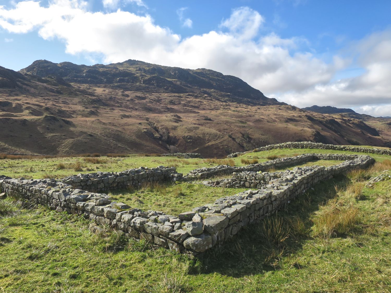
AW:
Now this Roman fort has a Roman name, but is much better known as Hardknott Castle, and it’s well worth just a short distance that you have to walk to get to it. It’s in a remarkable state of preservation, partly because the Ministry of Works, some years ago, rebuilt some of the walls. But there you can see the commandant’s house, the granaries, the parade ground, everything’s laid out for you. And best of all, from my point of view, is the superb view of the Scafell range and the head of Eskdale that you get from the north gate of the fort.
Ron:
So you can look right up the River Esk, as far as you can see?
AW:
Right up to the Scafell range. That’s the great appeal of Hardknott to me, because I’m not an antiquarian or an archaeologist.
Ron:
I believe from fragments excavated that the fort was garrisoned by a cohort of the Dalmatians. Sounds like a number of dogs, but I presume that’s what we now call Yugoslavia. How do you think they would feel, these soldiers who were used to the sun on their backs?
AW:
Yeah, very lonely indeed, very cold. But the fort occupies a very strategic position. It commands a view of the whole of Eskdale and really is a place to see.
Ron:
So, it’s well worth stopping for half an hour, and you want to explore?
AW:
You won’t find a better example in the Lake District of a Roman fort, and there are about a dozen of them.
Ron:
That’s a real target for them, for motorists?
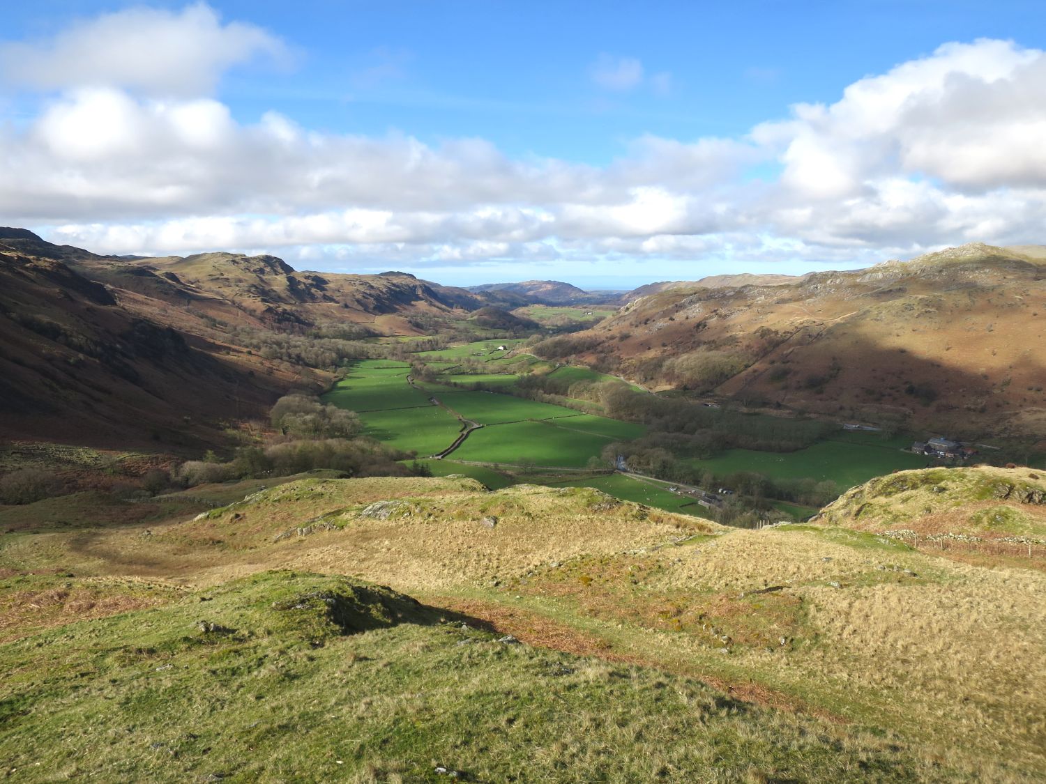
AW:
After leaving there, you’re quickly down in the beautiful valley of the Esk, with the River Esk flowing alongside, and you follow the road down, and it’s widening now, because it gets more traffic in the valley.
Ron:
Now, what attractions are there, AW, for the traveller, for the motorist, for the walker?
AW:
Well, it’s no attraction to me, but there is a youth hostel. More attraction to me is the Woolpack Hotel.
Ron:
Indeed, a bit further down, yes.
AW:
And then the quaint little, hardly a village, of Boot. Well worth a stop, and from Boot, you can follow a moorland road over Burnmoor Tarn to Wasdale Head, and that’s an old corpse road again. Or you can wander up the other side of the valley to Birker, on Birker Moor. There’s Birker Force there. There’s Dalegarth Force.
Ron:
So, you’ve got walks, short walks, for the motorists, but these aren’t mountain excursions, but discriminating walks for the walker?
AW:
Discriminating walks for the walker, and then especially for the crowds of people who come up to Boot, on the little railway, called The Ratty. Now these are short walks that they can well do between trains, and then you’re away down to Ravenglass, where there’s another fort.
6. Ravenglass
Ron:
Well, AW, we’ve made our journey over the Wrynose Pass and over the Hardknott Pass, and past the Roman fort and down Eskdale, and we’ve arrived at the little village of Ravenglass. What other attractions does this little place have?
AW:
For most people, the railway station, from which sets off The Ratty, the little steam train that runs up Eskdale.
Ron:
A great attraction for people?
AW:
Yeah, that’s the bigger attraction for most people. The Romans were attracted to it because it’s a natural port, and there’s the fort and the bath houses still to be seen.
Ron:
And they’re all very accessible?
AW:
Yes, it’s a charming little village off the main road. The road through it actually ends on the beach, with water lapping it. And there’s a gullery there. Nearby is the stately home of Muncaster Castle. The grounds are open to the public.
Ron:
And I believe it has very, very attractive gardens?
AW:
Very attractive, especially in spring. It’s rhododendron, azalea, mostly.
Ron:
So, the motorist, when he wants to relax and he needs to see something very beautiful, Muncaster Castle is just as accessible?
AW:
Yes, and it has an extensive car park, the first car park he’s seen on this journey from Ambleside.
Ron:
Yes, he’s been too busy watching where he’s going over the two passes!
<<>>
A Personal Reflection
The recording is exactly what Ron intended: a straightforward conversation. He asks the questions and allows Alfred Wainwright to answer them in his own way. What comes through clearly is Wainwright describing the landscapes he knew well, in plain terms, without any need to present or perform.
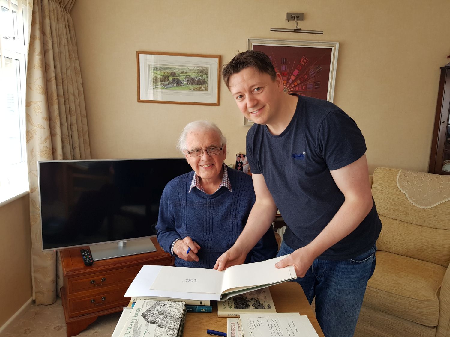
Ron handled the recording in the same way he wrote and spoke. He asked clear, direct questions and allowed Wainwright to answer fully, without embellishment. When I first contacted Ron nearly ten years ago, and in the years that followed, he was always kind-natured, practical and grounded in experience.
We spoke regularly by email and phone, and during the summer of 2019, my wife, Priscilla, and I visited him at his home in Staffordshire. He spoke in detail all afternoon about his life and his time with Wainwright. It was a pleasure to spend time learning from him, and we will always cherish the memory.
Following the visit, we kept in contact, particularly while I was working on the Wainwright exhibition at The Armitt, for which he gave valuable advice and was acknowledged as a contributor. The final time we connected was in 2025, while the exhibition was underway. He had hoped to attend, but by then he was not well enough to travel.
Ron passed away shortly after at the age of 96, and my wife and I miss him dearly. He was one of the few people who knew Wainwright personally and could speak about him first-hand. This recording remains part of his work; one I have no doubt he would have been pleased to share.
<<>>
Thanks, sources and further reading:
Chris Butterfield of Alfred Wainwright Books & Memorabilia
Chris’ Facebook Page: Alfred Wainwright
The Duff family for the photo of Alfred Wainwright
A special thanks to Andrew Nichol (1932–2024), who introduced Chris to Ron Scholes.