Author Archives for Richard Jennings
 August 15, 2026 10:57 am
Published by Richard Jennings
August 15, 2026 10:57 am
Published by Richard Jennings
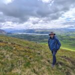
A regular visitor to the Lake District, Brenden has developed a deep affection for its fells, valleys, pubs, people and allegedly existent red squirrels. In this piece, he reflects on what keeps drawing him back to this very strange and wonderful corner of England. A Very Strange Place Bogs, false summits, mythical squirrels and one Australian’s unlikely love affair with the Lake District As an Australian, I arrived in the Lake District with a few assumptions. I had been reliably informed that Britain had no snakes, the weather was generally mild, and a “moderate walk” was something a reasonably fit bloke could complete without having to renegotiate the terms of his relationship with gravity. All three statements have since proven questionable. Britain may not have many snakes, but the Lake District has miles of exposed tree roots, wet bracken, loose stones and stick-shaped objects lying across paths. To an Aussie brain, anything long and brown deserves at least three seconds of careful consideration. I have crossed entire fields confidently enough, only to leap sideways because a twig looked mildly ambitious. The walking descriptions are not much more reliable. After several visits, countless miles and extensive field research conducted from both fells and pubs with suspiciously friendly locals, I have discovered that Cumbria has developed its own language. It sounds like English, but many of the words appear to have quite different meanings. A “moderate walk”, for instance, means you will begin questioning your cardiovascular fitness within twenty minutes. “Just over that ridge” means there are at least three more ridges, none of which were visible when the statement was made. And when a local tells you it is “not far now”, this should not be interpreted as a measurement of distance. It is more of a spiritual encouragement. Even the forecast gets involved. “Lovely day for it” generally means the rain is only coming from one direction. The Lake District treats forecasts less as promises than as creative suggestions. You can leave the car park in sunglasses, put on a waterproof halfway up, lose all visibility near the summit and return with wet socks, mild windburn and a completely different understanding of the word “summer”. The locals describe the weather as changeable. I would describe it as meteorological speed dating — sunshine, rain, wind and fog, each appearing briefly before deciding it can do better. Yet I keep coming back....
April 11, 2026 10:33 am
Published by Richard Jennings
Ron Scholes was a schoolmaster, later a headmaster, a BBC Radio Stoke broadcaster, and an established author of walking and countryside books. Over many years, he produced a substantial body of work covering northern England and beyond, including Walking in Eden, and guides to the Yorkshire Dales and surrounding regions, a range of visitor and landscape titles, and culminating in his final and most personal work, A Pennine Odyssey. His writing combined practical route knowledge with history and landscape, along with his detailed connection with Alfred Wainwright. He was also a committed long-distance walker, devising routes of his own, most notably the Ravenber Way from Ravenglass to Berwick-upon-Tweed. That walk was inspired by Alfred Wainwright’s own Coast to Coast Walk and reflected what Wainwright had hoped his 1973 guide would encourage others to do: to create their own journeys across country. Wainwright was pleased that his work had influenced Ron’s long-distance walk and had helped him devise it. Ron’s connection with Wainwright began in 1979 through correspondence, after Ron donated the proceeds of one of his illustrated talks to Animal Rescue Cumbria. From that point, a lasting friendship developed. Ron visited Wainwright and his wife, Betty, at their home at Kendal Green on several occasions, sometimes staying overnight, and they kept in regular contact through letters and meetings. Their discussions covered long-distance routes including the Pennine Way, the Coast to Coast and the Cambrian Way, as well as the practical side of writing and publishing guidebooks. Wainwright took a direct interest in Ron’s work, offering advice and encouragement over several years. That regard was further reflected in the dedication of A Peak District Sketchbook in 1984, Wainwright’s final sketchbook, to Ron. Wainwright had intended to work on further projects with Ron, but by this stage, his eyesight was failing, and he was no longer able to continue. It was through this friendship that Ron arranged to record a conversation with Wainwright about the road over Wrynose and Hardknott. The recording was made in 1987 using a 5-inch reel-to-reel tape recorder borrowed from BBC Radio Stoke. Ron later wrote that after the interview, he moved house and the tapes were mislaid, remaining lost for many years. They were only found after Wainwright’s death, when a friend of Ron’s, David Burrowes, edited the tapes and copied them onto disc, preserving the conversation. I first contacted Ron by email in 2017, and we...
February 13, 2026 2:35 pm
Published by Richard Jennings
I’ve logged many hours running in and around the Lakes, so when I happened across this route linking up many of my favourite places in one route, I was keen to give it a go. I was very lucky with my chosen weekend; the selection of the dates was based mainly on when neither my partner nor I were due to be working and far enough after Christmas, so I was also very lucky with the timing of low tide on Saturday 7th February, with dawn around 7:50am and low tide coming in around 8:45am. I set off from Ravenglass at 8:05am with my Crocs in hand to complete the first few legs solo. Unsure where exactly to start and wanting to find somewhere that equalled Moot Hall or Glen Nevis YHA, we found a suitable flagpole just off the main street. The tidal crossing was easy enough, coming around knee-deep at most, but was really cold! The Crocs in sport mode were great for keeping my feet mostly clean and, after meeting the car for a quick towel and getting my socks back on, I set off along the road to get into the hills proper. Meet-ups at Birker Fell, Hardknott cattle grid and Walna Scar Road helped a great deal and meant I was carrying enough supplies for emergencies and a few hours of food. After the road sections, I got a taste of what the weather might have in store for me, with quite a strong cutting wind whipping behind me as I ran up Birker Fell. The first few meet-ups with the car were rapid: a quick water bottle change and gone again in less than a minute. The trails around Boot and Seathwaite were delightful. I thought I knew the areas from other races and events, but the single tracks were lovely and flowy, and the sections from Wallowbarrow Crag to the Fickle Steps crossing were pretty gnarly. If I was doing the descent from Hardknott to Wallowbarrow in summer, I would be very wary of ticks. The trails were so quiet that it wasn’t until the base of the Old Man of Coniston that I passed my first hiker, several hours in! The rest of the trail flew by, with company from Tilberthwaite until Keswick, help on the bike around Little Langdale, club mates around Grasmere, and company over High Street and from Patterdale...
January 7, 2026 2:01 pm
Published by Richard Jennings
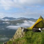
One of the pleasures of mountain camping is the chance to sleep under the stars in a beautifully remote location. However, there are several things to consider before packing your tent and heading for the hills. Mountain camping is a form of the more general practice known as wild camping — but is it actually legal? Do you need the landowner’s permission? And what guidelines should you follow? Firstly, it’s important to be clear about what is meant by ‘wild camping’. At its simplest, it means camping outside an official campsite, usually in a remote, natural location. For most hillwalkers and mountaineers, it’s understood as a fleeting and discreet overnight stay far from roads and settlements — typically high on the hills, well away from towns and villages, travelling light with a small shelter, and disappearing the next morning leaving little more than a faint impression on the grass. <<>> Wild camping in the Lake District Wild camping is technically not permitted anywhere in the Lake District without the landowner’s permission. In England and Wales, the Countryside and Rights of Way Act 2000 (the CRoW Act) grants the public a right of access on foot to land mapped as mountain, moor, heath, and down, collectively defined as ‘Open Access land’. However, if you wish to camp on this land, you are still legally required to seek the landowner’s consent — and since there are no complete, publicly accessible records of land ownership, this is rarely practical. That said, much like in Scotland, there is a long tradition of camping in the hills, which many landowners including the National Trust, the owner of much of the fellside in the Lake District — acknowledge. So while wild camping is technically a trespass, it is generally tolerated provided you act responsibly and follow the accepted guidelines. <<>> What are the guidelines? A wild camping code of conduct has been produced by several organisations, including the National Trust and the Lake District National Park Authority. While the exact wording of these guidelines may differ, they all share the same aim: to ensure camping on private land remains tolerated. The code is designed to help campers minimise their impact on the landscape, wildlife, and local communities, and to make sure the tradition of wild camping can continue for future generations. The rewards of camping high on the Lakeland fells are well worth the effort if...
December 2, 2025 2:25 pm
Published by Richard Jennings
The Lake District is famous for its landscapes and formerly resident literary giants William Wordsworth and Beatrix Potter, associations that for me conjure up images of crowded trails where I do not want to be. At one end of the scale there are the multitudes seeking Peter Rabbit and, ironically, the solitude of lonely clouds, and at the other, the insanely fit running up and down fells, bagging Wainwrights (the 214 peaks listed in Alfred Wainwright’s Pictorial Guide to the Lakeland Fells, 1955-66). I confess this perception was based solely on two weekends in the region: the first in 2008 for the ultra-marathon Lakeland 50, so most of it I don’t really remember because I was too knackered. The second in 2023 was a weekend camping at Coniston to climb Hellvelyn via Striding Edge, which was stunning, but reminded me of a) the crowds, and b) that I don’t sleep well when people are driving cars across campsites. But with two weeks falling clear for hiking in late summer, a route was needed where I didn’t have to go too far from London or that needed too much preparation. The Lakeland Way is a new (ish) 144 mile trail designed by Richard Jennings, who has kindly added the maps, gpx, and suggested camping on the website, and promises the less popular trails. All I needed to do was follow a track with plenty of deviations to be had along the way if I wanted. The only real stressor was getting there. The rail network did its best to demonstrate the collapse of British civilisation: cancelled train at Euston, alternative found and cancelled, another alternative found but bumped off at Crewe, another alternative was cancelled at Lancaster. I rounded up two other stranded hikers and we taxied to Barrow-in-Furness where a two-carriage diesel train finally made an appearance for the last leg. As we chugged along, hours behind schedule and £100 out of pocket, it became impossible to hold onto annoyance. Crossing into an enigmatic landscape of mountain, light and sea, I arrived at Ravenglass to claim a pitch under a tree canopy scattering the last golden hour of a long day. I asked the murder of crows above to cease their cawing and settled down for the first of 12 nights on terrain marked by centuries of interconnection with humanity, stretching well beyond today’s fans of fellrunning, Wordsworth and Potter....
June 5, 2025 12:44 pm
Published by Richard Jennings
Good art transforms a space. It introduces something new, often forged from foreign materials like canvas, paint, bronze or stone and worked into a form that redefines and enriches its setting. It can bring the outdoors in, or life to a sterile cityscape. But placing artworks in natural settings can be problematic. The Countryside Code compels us to leave no trace of our presence, so the notion of introducing something man-made is counter intuitive. Even given an artist’s skill in complementing their surroundings, it seems somehow arrogant to assume we can improve on nature. And yet we do this all the time. Agriculture and horticulture are both attempts to instil an artificial order on the natural world, editing out the bits we don’t want and cultivating the bits we do. Why should a well-tended flower bed be somehow less of an aberration than a sculpture made from concrete and steel? Perhaps because the garden showcases our stewardship of nature while the sculpture is an attempt to impose something alien upon it. A wheat field and a quarry are both examples of harvesting natural resources, yet one appeals to our sense of aesthetics while the other offends it. For all their artifice, the garden and the wheat field are part of nature; born of the wild, their order is ephemeral – if left untended, they will quickly revert. We may embrace art in the landscape, but we often find it less controversial when in the ordered environment of a garden or sculpture park; or perhaps, like Gormley’s figures on Formby beach, where we expect human activity. Placing artworks in wilder settings takes a special skill and sensitivity. It is these qualities that have enabled Andy Goldsworthy to succeed. Goldsworthy seldom imposes foreign objects on the landscape. Instead, he works with materials that are already there, like pebbles, petals, twigs and ice. His sculptures are designed to be washed away by waves, melted by sunlight, scattered by the wind. He simply reorganises parts of the environment, so they assume a fleeting new identity then lets the natural order reassert itself. Usually, the only enduring evidence is photographic. Some of his works persist a little longer, however. In 1987, he was commissioned by Grizedale Forest to produce “Taking a wall for a walk”, a dry-stone wall that snakes in and out of the trees as if the pull of nature had compelled it...
May 31, 2025 10:02 am
Published by Richard Jennings
During a wonderful trip backpacking the Lakeland Way in April this year, I took the opportunity to take notes of any issues along the route. Also, after further reflection, I’ve decided that a visit to Walna Scar Quarries is no longer part of the official route, but is now an optional diversion. There’s more about this decision further down this page. Because of this change, the GPX files or PDF maps downloaded before 05.05.25 should be replaced with the following revised files: Full GPX route of the Lakeland Way: Download Day 10 – Coniston to SeathwaiteGPX route: DownloadPDF maps: Download Day 1 – Ravenglass to Wasdale HeadRavenglass station footbridge In 2024 Network Rail announced plans to fully refurbish the footbridge at Ravenglass station on the Cumbrian Coast Line. Although the footbridge is not on the LW route, anyone wanting to reach the start of the walk from Main Street will have to walk along the road and under the main-line bridge. Network Rail have worked with Cumberland Council to put in pedestrian diversion routes, with signage and safety barriers so people can still access both platforms during the work. The much-loved footbridge, first constructed in 1849, was due to be repaired in autumn 2023 with the timber deck being replaced. However, when engineers started work on the bridge, they found the condition was worse than expected and so a full refurbishment and repair was needed. Work began on site in February 2025, with the whole structure removed and transported to a repair facility to be worked on. This includes being fully repainted and restoring it to how it looked in its historic heyday. Doing this work away from the station means they don’t have to close the line and trains can continue to run. The footbridge will then be bought back to site and reinstalled at the station, with the timber deck replaced and safety checks carried out, and then reopened to passengers and the public. In March this year, Network Rail gave an update stating that they aim to have the bridge back open this summer: “The plan now is to work on the bridge offsite and reinstate the bridge in June over a weekend during planned engineering time, to hopefully minimise the impact on passengers. There will be some on-site work after this, such as replacing boards and screening.” Stepping stones near St Catherine’s Church Since I did...
September 4, 2024 9:30 am
Published by Richard Jennings
Several sections on the Lakeland Way include some exposed paths with light grades of rock-scrambling, so please take care and always check for weather updates and be prepared. Lake District conditions are very changeable, so always take the appropriate gear, plenty of food and water, and a vital one to remember is: “GPS devices are handy, but paper maps are essential”. We are happy to provide the detailed information that we do, but you are fully responsible for your own health and safety. If you have any questions regarding any of the sections, please don’t hesitate to contact us – we are happy to help. <<>> Be AdventureSmart Ask yourself three questions before you set off: For more information and advice: Adventure Smart <<>> Essentials for a safe journey <<>> What to do in an emergency <<>> Recommended GPS location apps GPS Location apps like OS Maps and What3Words work by translating the geo-location data on your phone into another ‘language’. With OS Locate Me (previously OS Locate), which is now integrated into the OS Maps app, the data is translated into two letters followed by either six or eight digits (eg: NY21350785), and for What3Words it is translated into three words (eg: ///ambition.interacts.creatures). The OS Locate Me language relates to your location according to the National Grid (eight digits are more accurate than six), while the What3Words language relates to a 3m square ‘box’ on the surface of the earth. Mountain Rescue Teams prefer an accurate six or eight digit grid reference, coupled with an accurate description of where you are. On the What3Words app you can change the settings to provide a grid reference as well as three words of your location. During your phone call to the emergency services it is going to be really beneficial if you can accurately confirm your location. The more accurate, the better. But this is where some mistakes are occurring: The two most common errors when using the apps are either that the phone still thinks it’s somewhere else (your phone lost signal in a dead spot at a previous location), or in transmitting the three words over the phone (they are either spoken or heard incorrectly somewhere along the process). For example, ///ambition.interacts.creatures locates you at the notorious junction of Piers Gill on the Corridor Route in the Lake District, while ///ambitions.interacts.creature locates you in the Republic of Congo! With...
August 21, 2024 8:53 am
Published by Richard Jennings
There has been a small route change on Day 4 between Buttermere and Braithwaite. Any GPX or maps downloaded before 21.08.24 should be replaced with the following files: Full GPX route of the Lakeland Way: Download Full GPX route of the Lakeland Way Ultra: Download Day 4 – Buttermere to BraithwaiteGPX route: DownloadPDF maps: Download As you approach the village of Braithwaite towards the end of Day 4, the usual route was to follow a short traverse from the old Force Crag mine road and then down to the village. This path, above Coledale Beck, usually becomes overgrown during the summer months, but in recent years it’s become far worse. In places, the narrow path has given way due to people trying to avoid running the gauntlet of gorse and brambles, and risk damaging those expensive waterproof jackets. Because of this, and with no signs of the path being maintained, a decision has been made to change the route to follow the old mine road to its end, and where it meets the Whinlatter road (B5292). The following images show the state of the path in August 2024: During a family day out enjoying the glorious weather, we decided to do a recce of the traverse. Two weeks prior to this Jaclyn was walking this section while on her Lakeland Way adventure, and had reported the condition of this path. Gorse and brambles now hinder progress along the path. This section is where clothing can get damaged as you try to push your way through the dense undergrowth. The decision has now been made to change this section on Day 4. Emily is seen here climbing up the steep bank and taking a shortcut back to the old mine road. The following three images show the traverse in April 2022, when the path is much easier to walk along: The next image shows the old mine road in May 2018, where it meets the Whinlatter road:
January 1, 2024 9:15 am
Published by Richard Jennings
3rd August 2023 – The Big LaunchThe website had been ‘live’ for a year, but folk were starting to come across the site while searching online, so it seemed the time was right to share it on social media. John Falcus, who had searched online for a walk from Patterdale, had come across the site by accident and contacted me on 20th June 2023, to say he was “hooked” on the route and was already in the “advanced” stages of booking his accommodation. John completed the walk on Saturday 29th July, and is officially the first person to walk the whole route in one go. I was absolutely delighted and privileged to cross the River Esk and walk with him for the last mile to Ravenglass. After following John’s adventure and seeing him complete the walk, this was the ‘kick up the butt’ I needed to launch the Lakeland Way and finally share it with the world. Up to this point only a few of my close friends knew about the project; people that had followed the process and provided much encouragement and guidance over the last few years. Even though there was still lots of content to add to the website, there was enough information for any person wanting to give this long-distance walk a go. So, on 3rd August I nervously shared the Lakeland Way on social media, and to be honest I was totally overjoyed by the positive feedback I received that evening. Some favourite comments and feedback: “Fantastic achievement in devising this Richard. Great to see you unveiling it. Can’t wait to walk it.”George Kitching “Richard – you probably won’t remember me, but in 2012 I walked the Coast to Coast and you provided me with some maps and advice for my first ever long-distance walk. I did it and raised £1500 for the Miscarriage Association and two years later I completed the Hadrian’s Wall path with my father – a fantastic father/son bonding experience. The walk you have created looks beautiful and I am inspired by your positivity and kindness. I think it’s so important for our own mental and emotional health to be getting outdoors and doing what you do – very inspiring! I just wanted to write this to say thank you and well done. What an amazing thing to have created this and then to share it with all of us. I...